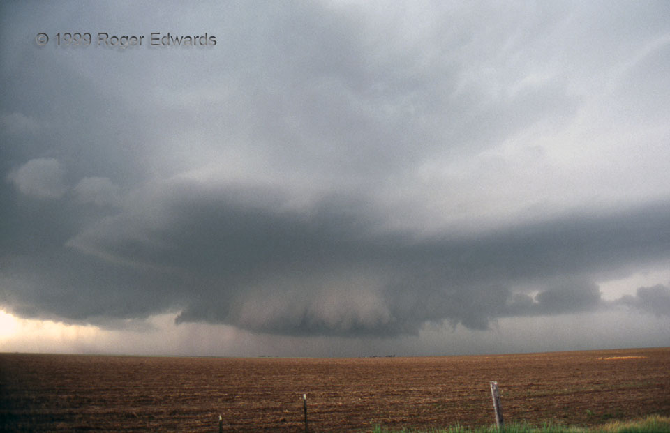
This wide-angle view of a very wet, classic supercell shows a wall cloud at lower middle, smooth accessory base above, tail cloud extending to the right, and a dense precipitation core to its rear. That rear area later would drop huge hail around 4 inches in diameter on some other chasers. Rapid rotation in the lower center portion teased tornadic potential; but outflow soon undercut the mesocyclone before it could do anything more. [The next mesocyclone in this storm’s sequence would, however, yield a weak but spectacular tornado.] This photo was taken only a few hundred feet from the spot where I had seen another wall cloud just a couple years before that had a brief tornado. Both storms dumped large amounts of destructive hail over several square miles of the same territory. By the end of this day, I reckon the handful of residents of southwestern Gray County, Texas, had grown tired of such abuse.
11 SW LeFors TX (20 May 99) Looking NW
35.2872, -100.9737
