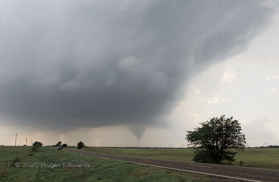
No, this won’t be the last Arnett tornado for ever and ever, but it was the final one from this supercell, even though the storm itself would spin northeastward for another couple hours before dissipating near the Kansas border. Why it stopped after this is rather mysterious, since it was moving into progressively greater moisture, stronger low-level shear and similar buoyancy. The storm became narrower and produced less precipitation after this, in a gradual transition from skeletal classic supercell categorization to purely low-precip (LP). I speculate, with some scientific basis, that the total precip decrease weakened both rear-flank downdraft baroclinicity and forward-flank vorticity generation (along an invisible streamwise vorticity current), each available to the mesocyclone, which itself was continually located in the north, forward-flank-adjacent rim of the updraft, as evident here by the tornado position. North-biased tornado positions are closer to forward-flank processes and imply a more direct dependence on them.
6 E Arnett OK (18 May 25) Looking W
36.1373, -99.6683