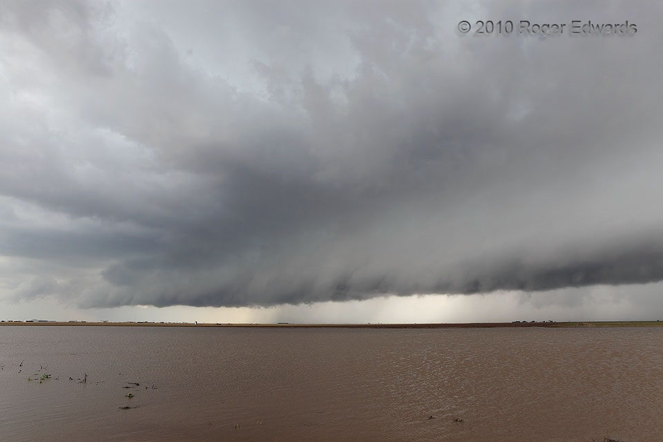
 No, this isn’t one of those classical arcus-cloud scenes from somewhere around the Rio de la Plata in South America. Instead, it’s the high, normally dry Texas Panhandle! As if a previous day of excessive rains in an already-wet spring weren’t enough, yet another thunderstorm loomed with its shelf cloud, ready to drench this stretch of farmland. Is Lake Perryton real? Not on any maps, it isn’t. Yet when the semiarid High Plains climate gets overwhelmed by Brazilian-style deluges, with no place else to drain in the vast flatness, a wide area can fill up with shallow, muddy runoff. The standing flood covered most of slightly elevated U.S. 83 also, but we had a lane of little to no water to afford passage. Between this and all the other stagnant water in the area, no wonder we felt besieged by mosquitoes on this day! Strangely, this seemingly outflow-dominant storm soon would evolve into a menacing supercell and produce two tornadoes (including this one) between here and the eastern part of the Oklahoma Panhandle.
3 S Perryton TX (13 Jun 10) Looking SW
36.3585, -100.803
No, this isn’t one of those classical arcus-cloud scenes from somewhere around the Rio de la Plata in South America. Instead, it’s the high, normally dry Texas Panhandle! As if a previous day of excessive rains in an already-wet spring weren’t enough, yet another thunderstorm loomed with its shelf cloud, ready to drench this stretch of farmland. Is Lake Perryton real? Not on any maps, it isn’t. Yet when the semiarid High Plains climate gets overwhelmed by Brazilian-style deluges, with no place else to drain in the vast flatness, a wide area can fill up with shallow, muddy runoff. The standing flood covered most of slightly elevated U.S. 83 also, but we had a lane of little to no water to afford passage. Between this and all the other stagnant water in the area, no wonder we felt besieged by mosquitoes on this day! Strangely, this seemingly outflow-dominant storm soon would evolve into a menacing supercell and produce two tornadoes (including this one) between here and the eastern part of the Oklahoma Panhandle.
3 S Perryton TX (13 Jun 10) Looking SW
36.3585, -100.803Lake Perryton
 No, this isn’t one of those classical arcus-cloud scenes from somewhere around the Rio de la Plata in South America. Instead, it’s the high, normally dry Texas Panhandle! As if a previous day of excessive rains in an already-wet spring weren’t enough, yet another thunderstorm loomed with its shelf cloud, ready to drench this stretch of farmland. Is Lake Perryton real? Not on any maps, it isn’t. Yet when the semiarid High Plains climate gets overwhelmed by Brazilian-style deluges, with no place else to drain in the vast flatness, a wide area can fill up with shallow, muddy runoff. The standing flood covered most of slightly elevated U.S. 83 also, but we had a lane of little to no water to afford passage. Between this and all the other stagnant water in the area, no wonder we felt besieged by mosquitoes on this day! Strangely, this seemingly outflow-dominant storm soon would evolve into a menacing supercell and produce two tornadoes (including this one) between here and the eastern part of the Oklahoma Panhandle.
3 S Perryton TX (13 Jun 10) Looking SW
36.3585, -100.803