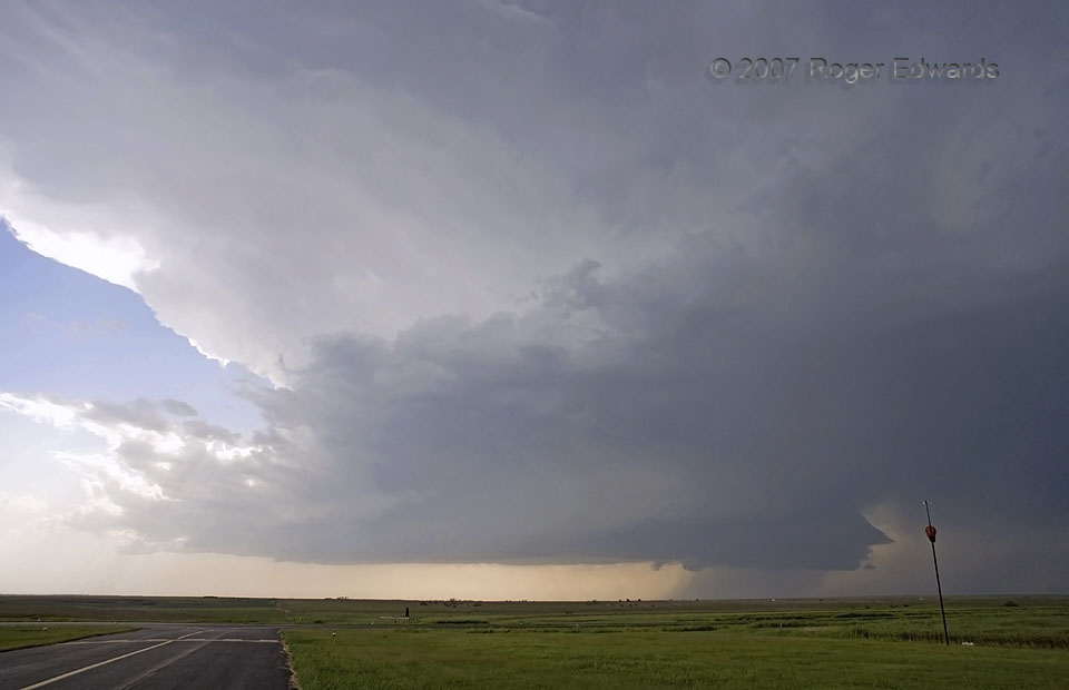
 I appreciated the honor and privilege of watching this western Kansas supercell for its entire lifespan, from first towers north of Dodge City to mature, well structured storm here, to producer of a pleasant little tornado E of St. Peter, to a rain-enshrouded mess shortly before dark, SE of Hill City. There’s a wholeness of conceptual grasp, a completeness of comprehension nearly unmatched in weather observation, that comes from bearing first-hand witness to every single shape, shade and shuffle of a storm’s long lifespan. It goes well beyond any single, short-lived event or phenomenon within—even a tornado—and more fully into the realm of understanding a process. This part of the process was dominated by strong inflow, so much so that the wind sock at the little Great Plains airstrip was pointing straight away from me and into the N side of the supercell’s updraft region, on command from the warm and moist inflow air that fueled the storm’s severity. Also, have you yet noticed that the right side of the storm looks like a facial profile of a long-nosed, small-chinned person with pouty lips?
1 S Wakeeney KS (22 May 7) Looking W
39.0083, -99.892
I appreciated the honor and privilege of watching this western Kansas supercell for its entire lifespan, from first towers north of Dodge City to mature, well structured storm here, to producer of a pleasant little tornado E of St. Peter, to a rain-enshrouded mess shortly before dark, SE of Hill City. There’s a wholeness of conceptual grasp, a completeness of comprehension nearly unmatched in weather observation, that comes from bearing first-hand witness to every single shape, shade and shuffle of a storm’s long lifespan. It goes well beyond any single, short-lived event or phenomenon within—even a tornado—and more fully into the realm of understanding a process. This part of the process was dominated by strong inflow, so much so that the wind sock at the little Great Plains airstrip was pointing straight away from me and into the N side of the supercell’s updraft region, on command from the warm and moist inflow air that fueled the storm’s severity. Also, have you yet noticed that the right side of the storm looks like a facial profile of a long-nosed, small-chinned person with pouty lips?
1 S Wakeeney KS (22 May 7) Looking W
39.0083, -99.892Inflow Sector
 I appreciated the honor and privilege of watching this western Kansas supercell for its entire lifespan, from first towers north of Dodge City to mature, well structured storm here, to producer of a pleasant little tornado E of St. Peter, to a rain-enshrouded mess shortly before dark, SE of Hill City. There’s a wholeness of conceptual grasp, a completeness of comprehension nearly unmatched in weather observation, that comes from bearing first-hand witness to every single shape, shade and shuffle of a storm’s long lifespan. It goes well beyond any single, short-lived event or phenomenon within—even a tornado—and more fully into the realm of understanding a process. This part of the process was dominated by strong inflow, so much so that the wind sock at the little Great Plains airstrip was pointing straight away from me and into the N side of the supercell’s updraft region, on command from the warm and moist inflow air that fueled the storm’s severity. Also, have you yet noticed that the right side of the storm looks like a facial profile of a long-nosed, small-chinned person with pouty lips?
1 S Wakeeney KS (22 May 7) Looking W
39.0083, -99.892