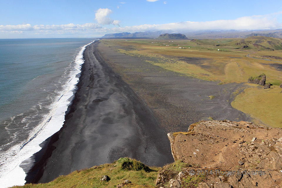
 Solid and liquid water, along with solid and liquid rock, sculpted this sweeping and majestic vista. The mesa from which this photo was shot, as well as the one at distant right, were parts of the mainland originally, then as the big, stormy waves of the North Atlantic pounded gaps around their resistant volcanic ledges, they became islands. The small pinnacle at middle right was a sea stack. Sediment later washed out from the mainland—mainly in multiple rounds of lahars (deep, high-volume slurries of ice, mud and rock) roaring out from sub-glacial eruptions of the big volcano Katla. Those events deposited enough material to fill the eroded gaps, forming new black-sand beaches farther seaward, remaking land where ocean had stood, and linking the islands back to the mainland again. A 1918 eruption, by itself, added up to 5 kilometers of shore. The same processes created the stunning coastline on the other side of the same mesa. Understanding geomorphology allowed deeper appreciation not only of the beauty of this scene, but how it came about, and how it can change greatly again as sea and land exchange assault blows.
3 WSW Vik, Iceland (16 Aug 14) Looking WNW
63.4032, -19.1318
Iceland’s Dyrholaey Coast
 Solid and liquid water, along with solid and liquid rock, sculpted this sweeping and majestic vista. The mesa from which this photo was shot, as well as the one at distant right, were parts of the mainland originally, then as the big, stormy waves of the North Atlantic pounded gaps around their resistant volcanic ledges, they became islands. The small pinnacle at middle right was a sea stack. Sediment later washed out from the mainland—mainly in multiple rounds of lahars (deep, high-volume slurries of ice, mud and rock) roaring out from sub-glacial eruptions of the big volcano Katla. Those events deposited enough material to fill the eroded gaps, forming new black-sand beaches farther seaward, remaking land where ocean had stood, and linking the islands back to the mainland again. A 1918 eruption, by itself, added up to 5 kilometers of shore. The same processes created the stunning coastline on the other side of the same mesa. Understanding geomorphology allowed deeper appreciation not only of the beauty of this scene, but how it came about, and how it can change greatly again as sea and land exchange assault blows.
3 WSW Vik, Iceland (16 Aug 14) Looking WNW
63.4032, -19.1318