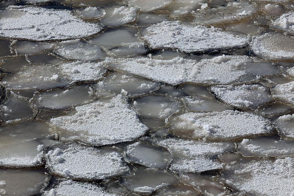
Polygonal ice formed on a very shallow (a few inches to a couple feet), relatively calm part of a Lake Thunderbird cove, as air temperatures slowly but relentlessly fell to below zero degrees F. This appears to be a hybrid of processes that form round “pancake ice” on open water, and “ice-wedge polygons” atop frozen landscapes with high water content. Clearly, chunks of ice that were not round in shape developed on the water. Raised edges happened with the chunks bumping into and accreting with each other, and as liquid pushed up through the last unfrozen seams between the polygons. Some (not all!) of the polygons held snow, which tells me the bigger ones froze just before the end of a snowfall, and the remainder at the end or shortly after, with the snow already having absorbed into cold water. Their murky color gives away the water source: the lake itself. Their shapes remind me of planed-off tops of columnar basalt pillars in field geology, where somewhat similarly, a liquid (in that case, a deep, cooling, well-mixed magma) solidifies and contracts into hexagons from the top down. Unlike lava turning to basalt, however, ice expands when it forms, closing tight gaps and squeezing intermediary contents upward and downward out of the seams. This is why these ice polygons have raised edges, whereas columnar basalt groupings have narrow but deep slits.
2 W Little Axe OK (15 Feb 21) Looking SSW
35.2323, -97.238
