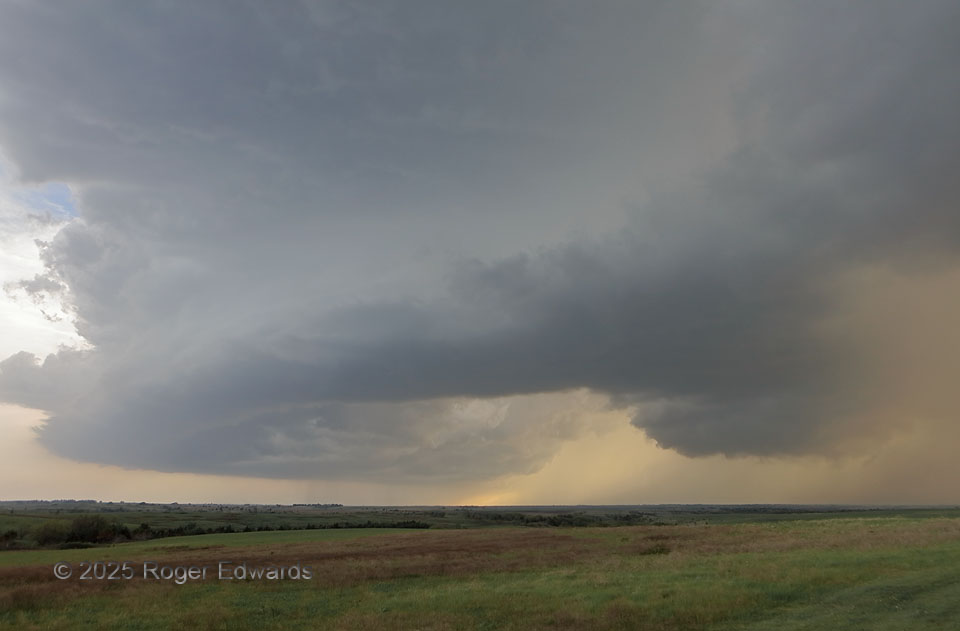
Following an outflow boundary trailing from a previous, fast-hauling supercell in northeastern Kansas, we found a younger yet mature storm, this one somewhat slower-moving and (for now, not for long) surface-based. The mesocyclone region of this supercell was at right, where a ragged wall cloud can be seen. Warm light of the “Golden Hour” sifted all through the storm, which wasn’t very dense. Its rear-flank downdraft acted like most downdrafts on this day, blasting out an outsized rush of cold outflow air that carved out the long, curved base dragging south and southwest (leftward) of the wall cloud. “Horseshoe bases” like this usually mean a supercell is in the process of blowing itself apart, though in some situations, the mesocyclone still may tighten up briefly and pull up a tornado before dying. This one decidedly did not. We soon left this for a scenic sunset on the tail end of all the convection.
4 SSW Wreford KS (28 Apr 25) Looking W
38.9156, -96.8535