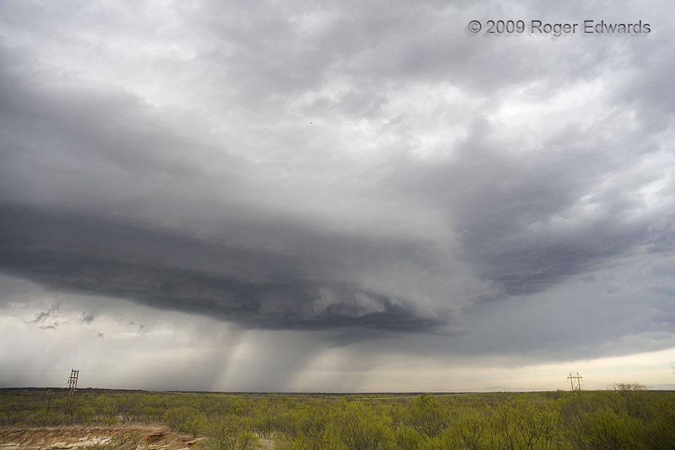
 The Easter Sunday 2009 supercell, in northwest Texas, makes a fine illustration of Chuck Doswell’s reminder that a storm isn’t an object, but rather, a process, often with dramatic changes in appearance and behavior over its lifespan. The thunderstorm actually cycled into and out of one supercell stage as I approached from the distance, then lost its organization and became increasingly flat and high based, with no visually apparent rotational characteristics. At this point, however, part of the base expanded and lowered, and “shelfy” looking striations began to get circular again. Radar velocity presentations also indicated some midlevel rotation with the storm at this time, as it passed steadily eastward across the expansive mesquite plains near Lake Arrowhead, southeast of Wichita Falls. The storm would intensify and change dramatically in structure again…
7 SSW Jolly TX (12 Apr 9) Looking N
33.7661, -98.3805
The Easter Sunday 2009 supercell, in northwest Texas, makes a fine illustration of Chuck Doswell’s reminder that a storm isn’t an object, but rather, a process, often with dramatic changes in appearance and behavior over its lifespan. The thunderstorm actually cycled into and out of one supercell stage as I approached from the distance, then lost its organization and became increasingly flat and high based, with no visually apparent rotational characteristics. At this point, however, part of the base expanded and lowered, and “shelfy” looking striations began to get circular again. Radar velocity presentations also indicated some midlevel rotation with the storm at this time, as it passed steadily eastward across the expansive mesquite plains near Lake Arrowhead, southeast of Wichita Falls. The storm would intensify and change dramatically in structure again…
7 SSW Jolly TX (12 Apr 9) Looking N
33.7661, -98.3805High-Based Supercell
 The Easter Sunday 2009 supercell, in northwest Texas, makes a fine illustration of Chuck Doswell’s reminder that a storm isn’t an object, but rather, a process, often with dramatic changes in appearance and behavior over its lifespan. The thunderstorm actually cycled into and out of one supercell stage as I approached from the distance, then lost its organization and became increasingly flat and high based, with no visually apparent rotational characteristics. At this point, however, part of the base expanded and lowered, and “shelfy” looking striations began to get circular again. Radar velocity presentations also indicated some midlevel rotation with the storm at this time, as it passed steadily eastward across the expansive mesquite plains near Lake Arrowhead, southeast of Wichita Falls. The storm would intensify and change dramatically in structure again…
7 SSW Jolly TX (12 Apr 9) Looking N
33.7661, -98.3805