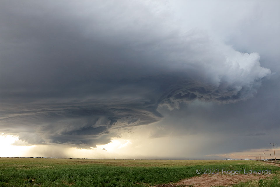
[Part 1 of 4] What became known as the “Hereford-Happy” supercell, with legendary structure for a long time, developed near the New Mexico line northeast of Clovis, then marched east-southeastward to southeastward across the Panhandle into the evening. The storm showed nice form earlier, but got very intense and cranked up the structural spectacle over Hereford. Here, we see a multiple tiers lit from different directions, with a broad, angular wall cloud under a smooth collar sporting a few small Kelvin-Helmholtz waves, in turn beneath a low/middle-level skirt. Stronger lift in the modestly rotating wall cloud signaled the location of the low-level mesocyclone, where the lowest pressure condensed rising air the quickest and lowest above ground, while successive tiers above represented areas where broader-scale lift overcame capping inversions to form higher condensation levels. Atop the highest skirt, the clouds get more obviously convective. Hidden within was a tilted, helically turning column of air rocketing upward at highway speeds. [Go to Part 2]
6 ESE Hereford TX (11 Jun 23) Looking NNW
34.8067, -102.3094
