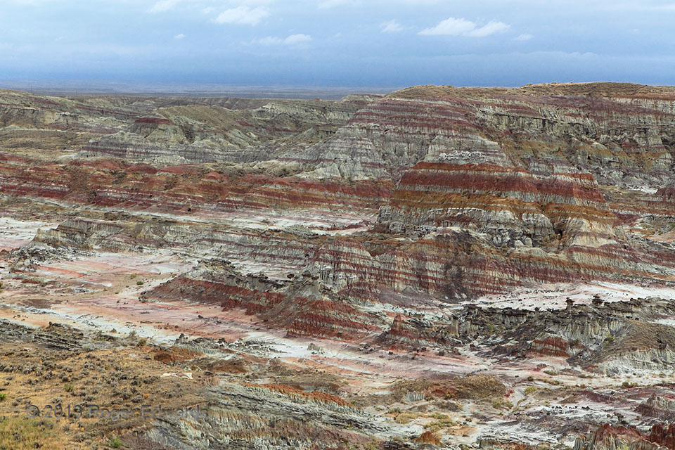
 The biggest “half acre” you’ll see at 320 to 960 acres (depending on how it is defined), the “hellish” version adorns one of the driest parts of an already dry state. However, on this day, the southern sky looked wet and heavy for a good reason. Intermittent light rain fell here along the northern rim of the same weather system, infused with moisture from former Pacific and Gulf of Mexico tropical cyclones Manuel and Ingrid, that caused disastrous floods around Colorado’s Front Range. Flash floods and wind have sculpted this badlands scarp out of a broad, high-elevation valley that essentially is a westward extension of the High Plains, tucked between the Rattlesnake and Bighorn Mountains west of Casper. Some of what used to fill Hell’s Half Acre now lies somewhere in Louisiana, thanks to the Powder, Missouri and Mississippi Rivers. Based on bones and artifacts found here, this is one of several sites across the Plains and West where tribal hunters drove bison off ledges to kill them.
5 WNW Powder River WY (12 Sep 13) Looking SSW
43.0459, -107.0932
Hell’s Half Acre
 The biggest “half acre” you’ll see at 320 to 960 acres (depending on how it is defined), the “hellish” version adorns one of the driest parts of an already dry state. However, on this day, the southern sky looked wet and heavy for a good reason. Intermittent light rain fell here along the northern rim of the same weather system, infused with moisture from former Pacific and Gulf of Mexico tropical cyclones Manuel and Ingrid, that caused disastrous floods around Colorado’s Front Range. Flash floods and wind have sculpted this badlands scarp out of a broad, high-elevation valley that essentially is a westward extension of the High Plains, tucked between the Rattlesnake and Bighorn Mountains west of Casper. Some of what used to fill Hell’s Half Acre now lies somewhere in Louisiana, thanks to the Powder, Missouri and Mississippi Rivers. Based on bones and artifacts found here, this is one of several sites across the Plains and West where tribal hunters drove bison off ledges to kill them.
5 WNW Powder River WY (12 Sep 13) Looking SSW
43.0459, -107.0932