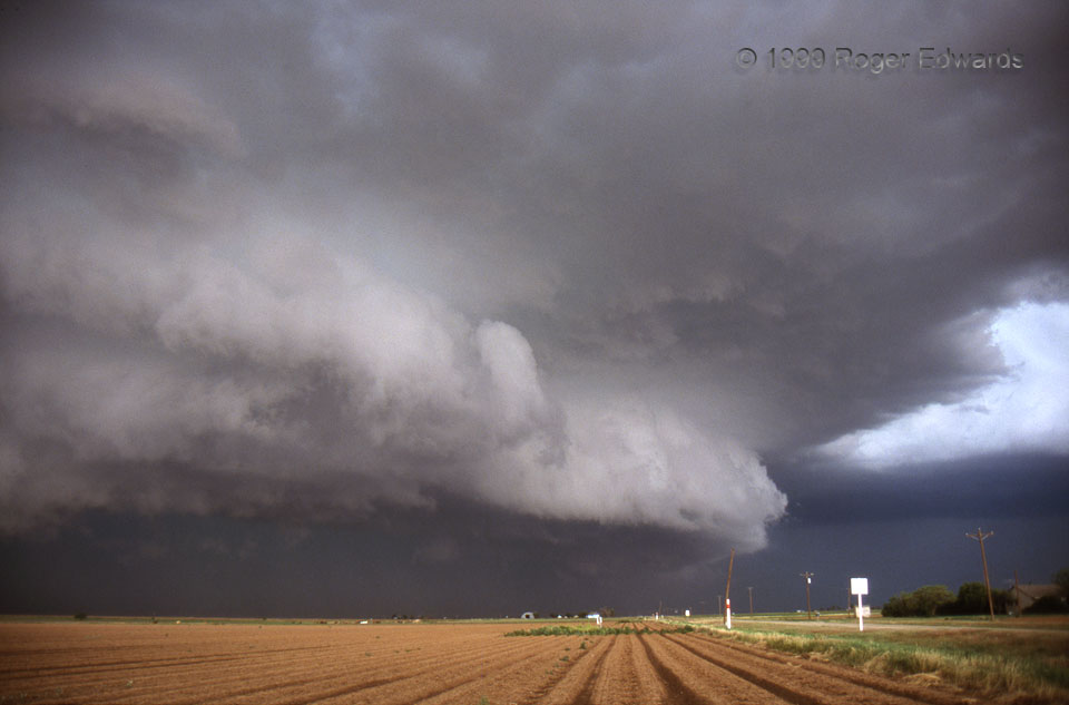
[Part 1 of 3] At first glance, this looks like a big, mean-looking shelf cloud belonging in the Gallery of Outflow. But look closer at the structures in this 28-mm wide-angle shot. Outflow at left and inflow at right are actually dancing a mesocyclonic tango. The HP (heavy-precipitation) supercell’s main precipitation core is at lower left (NNW), sending outflow eastward (from left to right) across the scene. There is a flanking line base with a bright “clear slot” partially visible at right (NNE), where warm, moist, convergent inflow is at a peak. The mesocyclone is in the middle, under the more distant portion of the shelf cloud curving away from view and low to the northern horizon. This is certainly not “textbook” structure! But the atmosphere simply doesn’t care one bit about our puny, oversimplified textbooks. It is actually rather common for HP storms to have intense mesocyclones on the “front” flank relative to their motion; and this one did. The nearest “town”, really just a dusty Great Plains crossroads, is one of many localities in the Texas Panhandle with interesting names. For me, this storm was a “Happy Union” of air masses. [Go to Part 2]
6 ESE Happy Union TX (25 May 99) Looking N
33.9924, -101.6093
