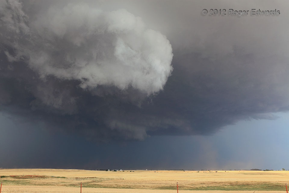
 Gustnadoes are whirlwinds that form in outflow air, disconnected from the cloud base above. They are not tornadoes, despite sometimes being misidentified by spotters or misclassified as such in official storm reports. Occasionally the winds in gustnadoes become strong enough for minor damage, and it probably is not a good idea to walk through them. Without trying, I’ve driven through one or two that nearly blew the vehicle off the road. Fortunately, this one didn’t cause any known harm, though it almost did become a tornado! How can that be? Here, the gustnado that developed along the leading edge of a supercell‘s rear-flank downdraft stretched vertically until its apparent top nearly got drawn into the updraft region of the mesocyclone—represented by the wall cloud at upper left. Had the vortex formed a continuum with the updraft above, it would have been a legitimate (albeit weak) tornado. In this case, we never could establish certainty that such a process came to full fruition, so we did not report this as a tornado. This storm did produce a bonafide tornado slightly over an hour later.
2 S Loyal OK (29 May 12) Looking E
35.9512, -98.1211
Gustnado near Mesocyclone
 Gustnadoes are whirlwinds that form in outflow air, disconnected from the cloud base above. They are not tornadoes, despite sometimes being misidentified by spotters or misclassified as such in official storm reports. Occasionally the winds in gustnadoes become strong enough for minor damage, and it probably is not a good idea to walk through them. Without trying, I’ve driven through one or two that nearly blew the vehicle off the road. Fortunately, this one didn’t cause any known harm, though it almost did become a tornado! How can that be? Here, the gustnado that developed along the leading edge of a supercell‘s rear-flank downdraft stretched vertically until its apparent top nearly got drawn into the updraft region of the mesocyclone—represented by the wall cloud at upper left. Had the vortex formed a continuum with the updraft above, it would have been a legitimate (albeit weak) tornado. In this case, we never could establish certainty that such a process came to full fruition, so we did not report this as a tornado. This storm did produce a bonafide tornado slightly over an hour later.
2 S Loyal OK (29 May 12) Looking E
35.9512, -98.1211