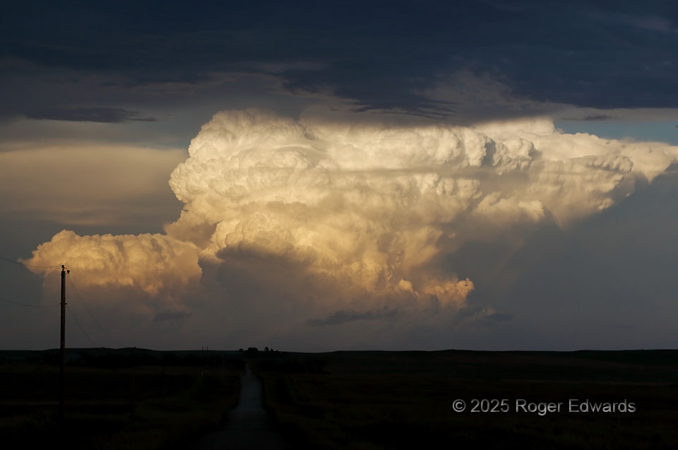
Towering deeply and brightly into the Golden Hour’s sunshine, a massive young cumulonimbus just had begun rotating nicely on radar and spotlighting the sky, about 75 miles to our east. Being too late to attempt to intercept this storm on the one road that “kinda sorta” went that way from where we were, it was best left admired from a distance. It was not just stunning, but a cloud connoisseur’s delight. A deck of midlevel altostratus (with a bit of altostratus undulatus on its edge) bracketed the storm visually in the upper foreground, along with a ground darkened not only by the shadow of that cloud layer, but thick anvil from a line of storms to our northwest. Two streaks of pileus clouds appeared above portions of the main updraft tower, just to the left of upper middle, while a longer, low, thin ribbon of cirrus cut in front of much of the supercell’s cloud rampart. Meanwhile the downshear, upper part of the updraft column produced downward-directed convective knuckle clouds, and a small amount of mammatus clouds are visible at far right.
5 NNW Rushville NE (1 Jul 25) Looking E
42.7854, -102.477