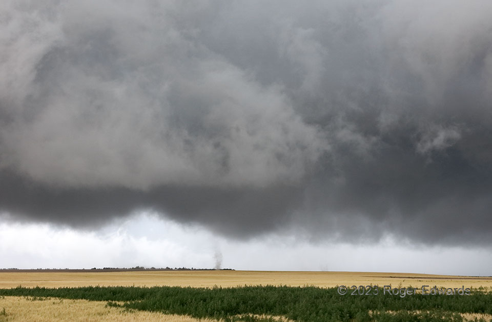
A broadly tornadic, multiple-vortex circulation continued under an unusually low, wet, scuddy cloud base for Colorado—a base that was intensely rotating, but lacking condensation funnel(s). Here, two subvortices can be seen: the obvious one just left of lower middle, and a fainter one to its somewhat more-distant right (NNW). Each rotated around the other, as well as on its own axis, with the common center of the broader circulation being pretty much in the middle of the shot. However, this was the end of the show. As subvortices were now forming within less than a mile, and the mesocyclone was starting to be kicked southeast by outflow from a rear-merging storm, it was time to go!
4 N Bethune CO (30 Jun 23) Looking WNW
39.3584, -102.4277
