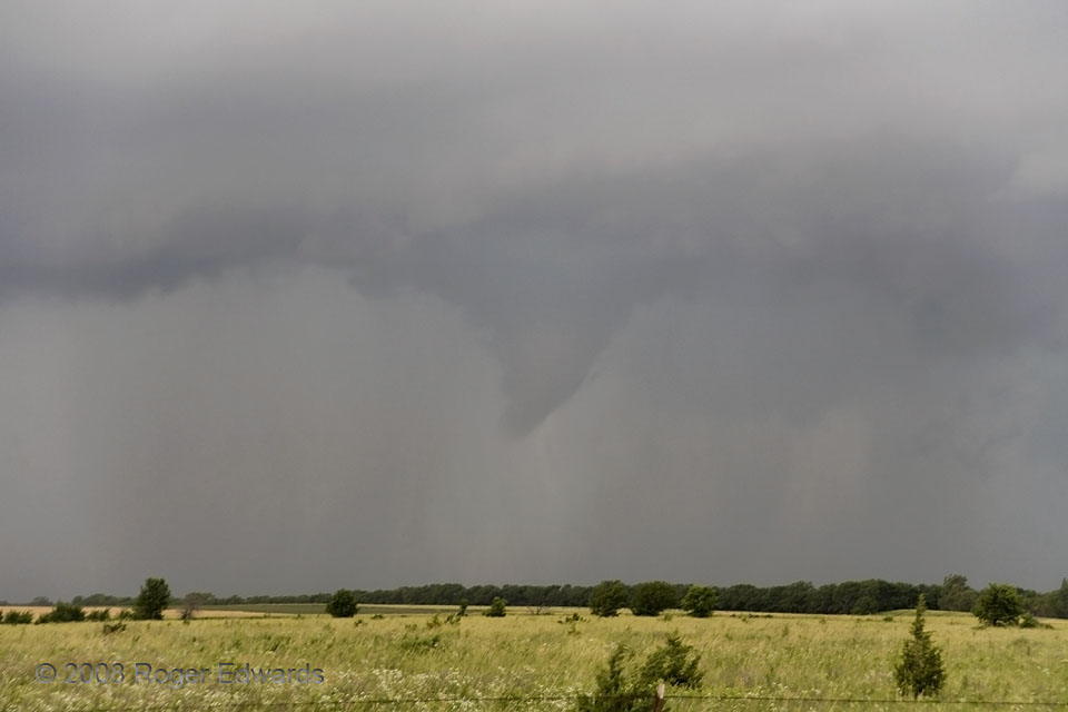
 We had watched two supercells move past the Emporia area already on this afternoon, and were trying to keep up with a rain-wrapped, outflow-dominant mesocyclone occlusion from the second as it raced eastward across the road to our N. About the time we decided to give up on that circulation and turn around to target other storms to our SW, this funnel cloud surprised us by forming under the supercell’s rain-filled flanking line, about a mile to our W. This is how you can get a non-mesocyclonic funnel from (indirectly) a supercell! I only had seen one other well-developed flanking-line funnel before, and that was in the form of a brief but damaging tornado on 3 May 1999.
Toledo KS (12 Jun 8) Looking W
38.423, -96.3736
We had watched two supercells move past the Emporia area already on this afternoon, and were trying to keep up with a rain-wrapped, outflow-dominant mesocyclone occlusion from the second as it raced eastward across the road to our N. About the time we decided to give up on that circulation and turn around to target other storms to our SW, this funnel cloud surprised us by forming under the supercell’s rain-filled flanking line, about a mile to our W. This is how you can get a non-mesocyclonic funnel from (indirectly) a supercell! I only had seen one other well-developed flanking-line funnel before, and that was in the form of a brief but damaging tornado on 3 May 1999.
Toledo KS (12 Jun 8) Looking W
38.423, -96.3736Funnel Cloud in the Rain…from a Flanking Line
 We had watched two supercells move past the Emporia area already on this afternoon, and were trying to keep up with a rain-wrapped, outflow-dominant mesocyclone occlusion from the second as it raced eastward across the road to our N. About the time we decided to give up on that circulation and turn around to target other storms to our SW, this funnel cloud surprised us by forming under the supercell’s rain-filled flanking line, about a mile to our W. This is how you can get a non-mesocyclonic funnel from (indirectly) a supercell! I only had seen one other well-developed flanking-line funnel before, and that was in the form of a brief but damaging tornado on 3 May 1999.
Toledo KS (12 Jun 8) Looking W
38.423, -96.3736