 When middle–upper-level troughs or lows move toward the Rockies and adjoining Great Plains, pressure at the surface falls, and a strong southerly to southwesterly current sets up just off the surface across parts of the plains and eastward—the low level jet (LLJ). Two common effects of a moist LLJ are visible in this shot. The first is obvious: scuddy low clouds, which evolve, come and go quickly as they race northward (far left to near right) from the Gulf of Mexico in the return flow. The second actually can be a surprise traffic hazard: moist pavement, the condensation sometimes so profuse that it can form slick surfaces and accumulate into puddles. This happens often on early springtime mornings, when the ground surface temperature is lower than the dew point of the return-flow air. On similar occasions I’ve seen many people—including a few meteorologists who work in the very building shown—tricked by such heavy wetting into mistakenly believing that it had rained. Within a few hours after sunrise, solar heating and vertical mixing typically dries and mixes the near-surface layer enough to evaporate the moisture once again.
Norman OK (26 Feb 9) Looking SW
35.1821, -97.4386
When middle–upper-level troughs or lows move toward the Rockies and adjoining Great Plains, pressure at the surface falls, and a strong southerly to southwesterly current sets up just off the surface across parts of the plains and eastward—the low level jet (LLJ). Two common effects of a moist LLJ are visible in this shot. The first is obvious: scuddy low clouds, which evolve, come and go quickly as they race northward (far left to near right) from the Gulf of Mexico in the return flow. The second actually can be a surprise traffic hazard: moist pavement, the condensation sometimes so profuse that it can form slick surfaces and accumulate into puddles. This happens often on early springtime mornings, when the ground surface temperature is lower than the dew point of the return-flow air. On similar occasions I’ve seen many people—including a few meteorologists who work in the very building shown—tricked by such heavy wetting into mistakenly believing that it had rained. Within a few hours after sunrise, solar heating and vertical mixing typically dries and mixes the near-surface layer enough to evaporate the moisture once again.
Norman OK (26 Feb 9) Looking SW
35.1821, -97.4386Fractocumulus of the Low Level Jet
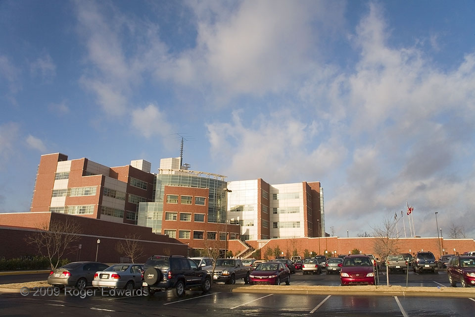
When middle–upper-level troughs or lows move toward the Rockies and adjoining Great Plains, pressure at the surface falls, and a strong southerly to southwesterly current sets up just off the surface across parts of the plains and eastward—the low level jet (LLJ). Two common effects of a moist LLJ are visible in this shot. The first is obvious: scuddy low clouds, which evolve, come and go quickly as they race northward (far left to near right) from the Gulf of Mexico in the return flow. The second actually can be a surprise traffic hazard: moist pavement, the condensation sometimes so profuse that it can form slick surfaces and accumulate into puddles. This happens often on early springtime mornings, when the ground surface temperature is lower than the dew point of the return-flow air. On similar occasions I’ve seen many people—including a few meteorologists who work in the very building shown—tricked by such heavy wetting into mistakenly believing that it had rained. Within a few hours after sunrise, solar heating and vertical mixing typically dries and mixes the near-surface layer enough to evaporate the moisture once again.
Norman OK (26 Feb 9) Looking SW
35.1821, -97.4386