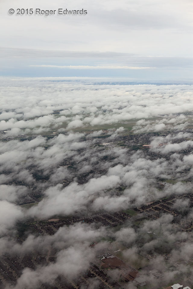
 The deep troposphere behind a convective complex often can be a richly layered melange of clouds. This was no exception. A broad area of outflow covered central and eastern Oklahoma from overnight thunderstorm clusters, scud (fractocumulus) in the rain-cooled boundary layer wafted across the area from the southeast, while streamers of altocumulus and a deck of anvil-residue cirrostratus layered the skies above. After takeoff from OKC airport, all became visible at once.
over Oklahoma City OK (13 Jun 15) Looking NW
The deep troposphere behind a convective complex often can be a richly layered melange of clouds. This was no exception. A broad area of outflow covered central and eastern Oklahoma from overnight thunderstorm clusters, scud (fractocumulus) in the rain-cooled boundary layer wafted across the area from the southeast, while streamers of altocumulus and a deck of anvil-residue cirrostratus layered the skies above. After takeoff from OKC airport, all became visible at once.
over Oklahoma City OK (13 Jun 15) Looking NWFractocumulus from Above
 The deep troposphere behind a convective complex often can be a richly layered melange of clouds. This was no exception. A broad area of outflow covered central and eastern Oklahoma from overnight thunderstorm clusters, scud (fractocumulus) in the rain-cooled boundary layer wafted across the area from the southeast, while streamers of altocumulus and a deck of anvil-residue cirrostratus layered the skies above. After takeoff from OKC airport, all became visible at once.
over Oklahoma City OK (13 Jun 15) Looking NW