SkyPix

A digital photographic storybook of clouds, weather and water by Roger Edwards.

  • Home
  • Newest Posts
  • Galleries
    • Aerial
    • All Hail
    • Burnscapes
    • Daytime Lightning
    • Floods
    • Fog and Mist
    • Gallery of Outflow
    • Hurricane Andrew
    • Mini Cloud Atlas
    • Night Lightning
    • Mostly Okie Winters
    • Sunsets and Sunrises
    • The Majestic Supercell
    • Tornadoes
    • Unusual Weather Damage
    • Visual Effects
    • Wall Cloud Wall
    • Water Works
  • About
  • F.A.Q.
  • Contact

Forward-Flank Tornadoes

2024-08-17 By Roger Edwards

Forward-Flank Tornadoes

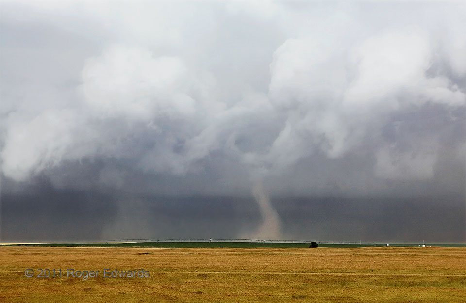
This storm, which I intercepted just south of the Kansas/Nebraska line already hours into its morning-to-midday trek across western Kansas, truly was one of the strangest supercells I’ve ever witnessed, as it moved from left to right (SSW-NNE).   Not only did it yield a series of big tornadoes in the main mesocyclone region (one of which I sometimes could see as a rain-wrapped wedge), it spun up several more on the forward-flank inflow/core interface roughly in the path of the mesocyclone.  The various “forward-flank” tornadoes, including these two, were much smaller and shorter-lived than the mesocyclonic brute roaring up from behind (off-screen left).  Each of these interesting little tornadoes (I saw at least five, not counting the huge one in the mesocyclone) formed under relatively small updrafts attached to the main storm.  This gave most of them them a “landspout” appearance, despite being supercellular, and sometimes with a narrow condensation funnel above the rotating dust (as with the one at right).   The storm, which was collocated with a deep-layer cyclone, zippered up a narrow zone of favorably unstable inflow along an occluded front, a boundary that also appeared to have a lot of cyclonic shear and vorticity as well, based on these results.  All the tornadoes I could see ahead of the main mesocyclone were themselves cyclonic.  I didn’t post these until 2024 because the contrast was low, but finally figured there’s some value in illustrating a rare process like this.  Once this storm died in southern Nebraska, we still (barely!) had time to go east on I-80 and see three more tornadoes from storms on the dryline, well east of the occluded low.

3 S Long Island KS (20 Jun 11) Looking WNW
39.901, -99.5354

RADAR

Filed Under: Tornadoes Tagged With: clouds, convection, Great Plains, Kansas, landscapes, Long Island, storms, supercells, thunderstorms, tornado, weather

Previous: Lofty Rankin
Next: Midlevel Sunset Tower

About

Welcome to SkyPix, an online photo book of clouds, weather and water by Roger Edwards. As in a printed coffee-table book, every image has its own page with a unique story. After all, meaningful photography is much more than just picture-taking; it is visually rendering a moment in place and time from a perspective like none other. As a scientist and an artist, I hope my deep passion for the power and splendor of our skies and waters shines through in these pages. If you are a cloud and weather aficionado, outdoor enthusiast, outdoor or nature photographer, art lover, or anyone who craves learning, enjoy...

More

Further images from this photographer may be found at:
Roger Edwards Image of the Week
Roger Edwards Digital Galleries
Storms Observed Chase BLOG

Copyright © 2025 ROGER EDWARDS SKYPIX.PHOTOGRAPHY ALL RIGHTS RESERVED. · Design by INSOJOURN Design and Images · WordPress · Log in