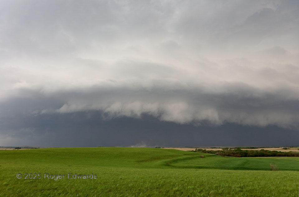
Following a few hours of non-atmospheric sightseeing in northeastern Kansas, waiting for storms to form along a slow-moving, partly stalled boundary, storms erupted all along it in quick succession. That wasn’t a desired outcome in an environment that favored nice supercells if that didn’t happen. So we made the best of the mess, intercepting the first embedded supercell to roll up the line. It had a dense, dark, heavy-precip (HP) structure, and moved a little faster than the mean wind. That told me the storm would be surfing its own outflow and likely look like this, even before we could see anything but dark murk in the distance. Still, that was fine; HP storms often are photogenic, as is almost any sky over the green mat of the Flint Hills. After the gust front passed our location, the shelf cloud’s underbelly was quite a sight to behold!
2 S Wabaunsee KS (28 Apr 25) Looking WNW
39.1167, -96.3458