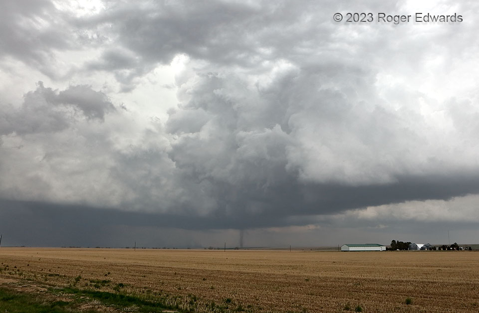
Here is a “nonsupercell” tornado, a.k.a. “landspout”, from a supercell. How is this possible? The seeming self-contradiction involves a common name for a non-mesocyclonic tornado, which this was, under the flanking line of a young, intensifying supercell. One of the flanking towers, despite being under heavy overcast from a large collective anvil shield, still was vigorous enough to stretch some pre-existing, horizontal, boundary-layer vorticity into the vertical for a few minutes of this action, until outflow from the left (northwest of the tornado) undercut it. Outflow dust can be seen approaching the bottom of the tornado from the left. Regardless of its non-mesocyclonic origins, it still counts as a tornado due to its full connection between ground and cloud base of the deep convective column.
6 S Woodrow CO ( 10 May 23) Looking NE
39.8983, -103.5923
