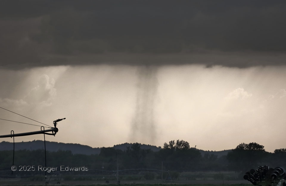
One of a pair of multicells, that we had been observing south through southwest of North Platte, became dominant with a large updraft base, and started to produce nonmesocyclonic “landspout” tornadoes. This was the first of several, exactly how many being uncertain due to distance, continuity and the diffuse character of some of them. Crucial question: “Did a new one form in the same area, or was it a continuation of the old one?” Fortunately this initial “spout” was unambiguous. The remainder, I was conservative in counting, and assumed continuity if the dust tube became hard to see, but intensified again in essentially the same place shortly after. Much of how, and how much, these raise dust has to do with the surface over which they pass, with plowed fields (especially dry ones) being the best for bringing out the definition of the circulation. In this case, my zoom lens worked (it failed soon thereafter) and the tornado appeared to be a double-walled vortex, with an inner and outer tube.
2 ESE Maxwell NE (14 May 25) Looking W
41.0673, -100.4893