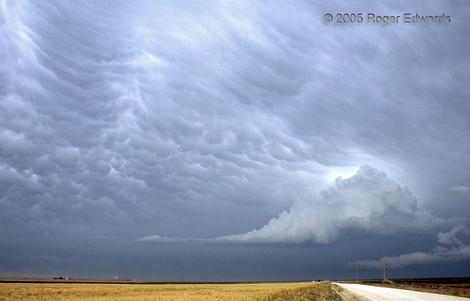
 The storm intercept was over before it began, in a way, as a gigantic complex of thunderstorms (mesoscale convective complex, or MCS) erupted over much of the Texas Panhandle early in the afternoon. Its cold outflow pool surged outward in every direction, hosing out all surface-based instability, and causing us to give up on any hope of a tornado or supercell for the day. Having secured a room for a relaxing evening in Dalhart, we noticed that the low clouds had cleared away and opened up a photogenic sky to the east, and drove outside town a little ways to get a clean vantage. A peculiar little rotating updraft appeared in the southern sky and moved NE until it was E of us, at the time of this film slide. The convective tower obviously was rooted in warm and moist layer, elevated way above the stable surface air and on top of the outflow pool. It lasted about an hour, sweeping away bags of mammatus along the way as if doing its part to clean the anvil cloud ceiling overhead.
2 SE Dalhart TX (10 Jun 5) Looking E
36.0507, -102.486
The storm intercept was over before it began, in a way, as a gigantic complex of thunderstorms (mesoscale convective complex, or MCS) erupted over much of the Texas Panhandle early in the afternoon. Its cold outflow pool surged outward in every direction, hosing out all surface-based instability, and causing us to give up on any hope of a tornado or supercell for the day. Having secured a room for a relaxing evening in Dalhart, we noticed that the low clouds had cleared away and opened up a photogenic sky to the east, and drove outside town a little ways to get a clean vantage. A peculiar little rotating updraft appeared in the southern sky and moved NE until it was E of us, at the time of this film slide. The convective tower obviously was rooted in warm and moist layer, elevated way above the stable surface air and on top of the outflow pool. It lasted about an hour, sweeping away bags of mammatus along the way as if doing its part to clean the anvil cloud ceiling overhead.
2 SE Dalhart TX (10 Jun 5) Looking E
36.0507, -102.486Elevated Updraft and Mammatus
 The storm intercept was over before it began, in a way, as a gigantic complex of thunderstorms (mesoscale convective complex, or MCS) erupted over much of the Texas Panhandle early in the afternoon. Its cold outflow pool surged outward in every direction, hosing out all surface-based instability, and causing us to give up on any hope of a tornado or supercell for the day. Having secured a room for a relaxing evening in Dalhart, we noticed that the low clouds had cleared away and opened up a photogenic sky to the east, and drove outside town a little ways to get a clean vantage. A peculiar little rotating updraft appeared in the southern sky and moved NE until it was E of us, at the time of this film slide. The convective tower obviously was rooted in warm and moist layer, elevated way above the stable surface air and on top of the outflow pool. It lasted about an hour, sweeping away bags of mammatus along the way as if doing its part to clean the anvil cloud ceiling overhead.
2 SE Dalhart TX (10 Jun 5) Looking E
36.0507, -102.486