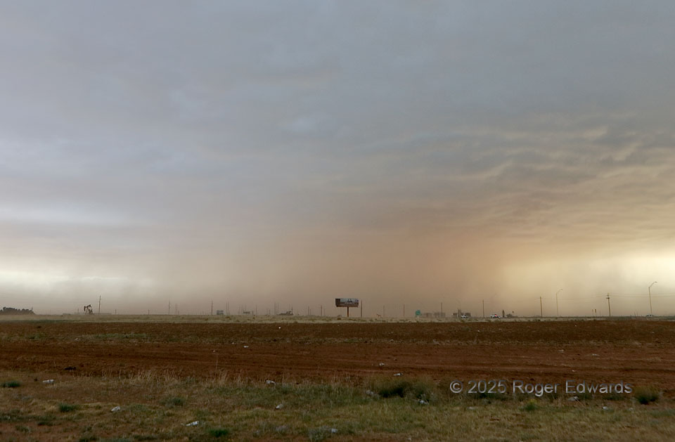
Yes, this isn’t the most photogenic scene; in fact, part of it is downright ugly (more below). Yet this was one of the most fascinating supercell processes I’ve seen in some time. Supercell? Absolutely! Even though the visible part of the cloud base is rather fuzzy and ragged, and the usual bands and tails ill-defined at best, there was a supercell updraft with strong low- to middle-level mesocyclone above the dust. The storm had formed along a slowly progressive outflow boundary near Midland, then moved ENE over it and over I-20. By the time the supercell reached Stanton, it was atop an ever-deeper outflow air mass 15–20 degrees F cooler than that which fed its initial updrafts. Instead of getting undercut, however, it persisted, probably because the mesocyclone was so intense that it forced cool, surface-based air into its updraft, that somehow still was buoyant. How do I know? Use your eyes. Look at the dust! It goes from surface up through cloud base—therefore, literally surface-based inflow, if only because of the mesocyclone’s forced ascent. Left only to CAPE, the storm would have been elevated and/or extinct long before now. The lesson for storm observers and operational meteorologists alike: Don’t presume a storm is necessarily elevated because it has been “undercut” by a baroclinic boundary, especially if it’s still a severe supercell on radar and the modified sounding still has some buoyancy in it, regardless of apparent inhibition strength. It may be elevated…or maybe not! The converging inflow dust was so dense it lowered visibility to less than 1/4 mile on I-20, which I reported with a phone version of this photo to NWS Midland, who quickly issued a dust-storm warning under the supercell. As for the ugly part (and not, it isn’t the Permian Basin’s “wasteland” landscape). Why the hell are there so many beer bottles strewn all over the grass and field here? Dumb, thoughtless, selfish bozos!
Stanton TX (5 May 25) Looking WSW
32.1364, -101.808