[Click Image to Enlarge]
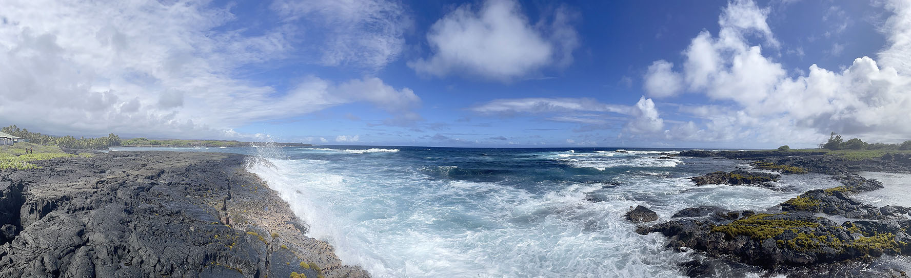
Can you almost smell the salt air? On this sporadically developed coast southeast of Hilo, and nearly as far from Honolulu as one can get on the main islands, a sense of wild Hawaii and a slower pace of life still resides in these parts, despite all the geological and meteorological action subtly at work here. The surf pounds on lava deposits that flowed from the East Rift of Kilauea over the past couple hundred years — still fresh enough to be bare and rough in spots. Palms at distant left lean to the left, revealing the wind direction that was, is, and will be for most of the time here: northeasterly, onshore. That flow goes upslope quickly just inland, lifting the boundary layer and causing the fractocumulus and stratocumulus development that lines up parallel to the seashore. Farther inland, east of Mauna Loa, more upslope lift condenses raindrops. Meanwhile, deeper cumuli are noted to the right (southeast) over a more strongly heated area of coast, with less vegetation and a darker land surface (lower albedo). Meanwhile, softer marine clouds (fractocumulus, cumulus humilis) and stratus streaks occupy the upper part of the Pacific marine layer. All of this happens beneath clean blue sky and pockets of altocumulus.
Hawaiian Beaches HI (11 Sep 25) Looking NW-NE-SE
19.5557, -154.8804