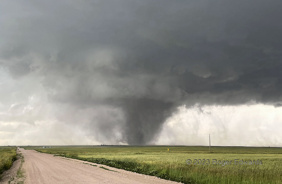
Rather like a puffer fish, this tall High Plains tornado (best manifest by the darkest, somewhat tilted column within the dust mass) made itself look much bigger than it was. It lofted enormous volumes of dirt from a plowed field, centrifuging much of the soil outside the radius of maximum winds, then into the surrounding, subcloud mesocyclone and rear-flank downdraft. Such behavior gave it an impressive, imposing appearance that stood out nicely for several minutes, until a descending core of rain wrapped around the circulation. I can imagine several tons of fine Nebraska Panhandle soil lofting into upper levels of the parent supercell, then blown downstream for hundreds of miles across the Mississippi Valley, some to fall in rain of the long-lived, damaging storm complex that ultimately grew out of this supercell’s upscaled circulation. I shot this image one mile north of the Colorado border.
14 SSW Kimball NE (28 Jun 23) Looking WNW
41.0327, -103.6865
