SkyPix

A digital photographic storybook of clouds, weather and water by Roger Edwards.

  • Home
  • Newest Posts
  • Galleries
    • Aerial
    • All Hail
    • Burnscapes
    • Daytime Lightning
    • Floods
    • Fog and Mist
    • Gallery of Outflow
    • Hurricane Andrew
    • Mini Cloud Atlas
    • Night Lightning
    • Mostly Okie Winters
    • Sunsets and Sunrises
    • The Majestic Supercell
    • Tornadoes
    • Unusual Weather Damage
    • Visual Effects
    • Wall Cloud Wall
    • Water Works
  • About
  • F.A.Q.
  • Contact

Dover Duster

2020-12-25 By Roger Edwards

Dover Duster

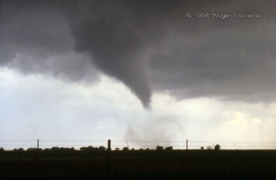
The early-stage Dover tornado began to organize better, whipping up a frothy column of slightly wettened dust as it crossed a plowed field where light to moderate rain had fallen briefly.  The bottom of the young vortex twirled slightly more than a mile away at this time, faintly audible as a distant waterfall noise, located to the southwest yet zipping along mostly eastward.  In this strongly tilted supercell, the tornadic vortex hidden above cloud base probably was overhead, around 5,000-8,000 feet aloft.  I looked up and around every few seconds, at the expense of shooting more slides, patrolling the very fluid cloud base for formation of satellite vortices that didn’t occur anymore.  With no substantial rain nor hail apparent either at my location nor in the surrounding mesocyclone, no rear-flank surges into the back side that could kick the tornado in an unexpected direction, a steady-state storm motion amidst fast midlevel flow,  no cloud-to-ground lightning in this part of the storm, and a known and fast, paved escape route, the typically dangerous northeastern vantage was relatively safe, in this particular situation.   However, to get an uncommon north-to-south viewing angle on this autumn tornado, I was risking a future descending-core cascade on the back side.  Fortunately, that never happened until after the supercell got past me.

5 WSW Dover OK (4 Oct 98) Looking SW
35.971, -97.9938

RADAR

Filed Under: Tornadoes Tagged With: clouds, convection, Dover, dust, Oklahoma, storms, supercells, thunderstorms, tornado, weather

Previous: Painted Mackinaw Sky
Next: A Superior Beach

About

Welcome to SkyPix, an online photo book of clouds, weather and water by Roger Edwards. As in a printed coffee-table book, every image has its own page with a unique story. After all, meaningful photography is much more than just picture-taking; it is visually rendering a moment in place and time from a perspective like none other. As a scientist and an artist, I hope my deep passion for the power and splendor of our skies and waters shines through in these pages. If you are a cloud and weather aficionado, outdoor enthusiast, outdoor or nature photographer, art lover, or anyone who craves learning, enjoy...

More

Further images from this photographer may be found at:
Roger Edwards Image of the Week
Roger Edwards Digital Galleries
Storms Observed Chase BLOG

Copyright © 2025 ROGER EDWARDS SKYPIX.PHOTOGRAPHY ALL RIGHTS RESERVED. · Design by INSOJOURN Design and Images · WordPress · Log in