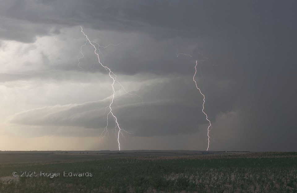
A formerly tornadic supercell churned southward then stalled out, as a new storm formed behind it to the northwest. The intensely electrified convective combination began hurling lightning as if it were an ill-tempered, venomous snake lunging repeatedly at an irritating intruder. Forked flashes like this, through clear air, were so common that I occasionally could catch more than one simply by cranking f-stop high, opening the aperture to a second or two in the dim, late-afternoon light under the combined anvil, and waiting. Fortunately the targets of this storm’s electrical fury were still a few miles away, about halfway between me and the low-level mesocyclone and wall cloud. These two discharges, in particular, reverberated for many miles and seconds with deep, booming thunder.
16 S Maywood NE (16 Jun 25) Looking NW
40.4374, -100.6513