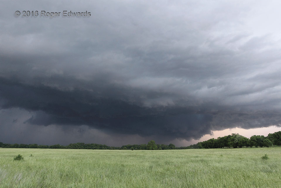
 This menacing-looking, borderline classic/HP supercell in southern Oklahoma formed along a progressive, southeastward-moving outflow boundary, but kept up with it, thereby maintaining warm-sector inflow. The updraft was large, elongated, deep and rife with areas of cyclonic shear, and intermittently but briefly strong rotation all along the large wall cloud. Our best view of it during the most threatening stage was over a low area near Lake of the Arbuckles called Catfish Bottoms. Though the storm never quite produced a tornado, it certainly kept us concerned and alert for a spell, before its profuse precipitation production finally undercut and surrounded the updraft area.
1 NW Drake OK (27 May 16) Looking NW
34.4053, -96.9597
This menacing-looking, borderline classic/HP supercell in southern Oklahoma formed along a progressive, southeastward-moving outflow boundary, but kept up with it, thereby maintaining warm-sector inflow. The updraft was large, elongated, deep and rife with areas of cyclonic shear, and intermittently but briefly strong rotation all along the large wall cloud. Our best view of it during the most threatening stage was over a low area near Lake of the Arbuckles called Catfish Bottoms. Though the storm never quite produced a tornado, it certainly kept us concerned and alert for a spell, before its profuse precipitation production finally undercut and surrounded the updraft area.
1 NW Drake OK (27 May 16) Looking NW
34.4053, -96.9597Danger at Catfish Bottoms
 This menacing-looking, borderline classic/HP supercell in southern Oklahoma formed along a progressive, southeastward-moving outflow boundary, but kept up with it, thereby maintaining warm-sector inflow. The updraft was large, elongated, deep and rife with areas of cyclonic shear, and intermittently but briefly strong rotation all along the large wall cloud. Our best view of it during the most threatening stage was over a low area near Lake of the Arbuckles called Catfish Bottoms. Though the storm never quite produced a tornado, it certainly kept us concerned and alert for a spell, before its profuse precipitation production finally undercut and surrounded the updraft area.
1 NW Drake OK (27 May 16) Looking NW
34.4053, -96.9597