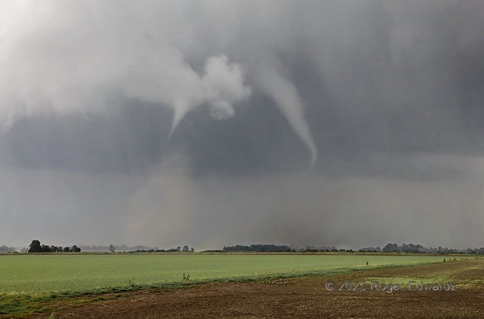
A “roaring bowl” became somewhat rain-wrapped temporarily, extending into this view, when a satellite tornado formed along the mesocyclone/rear-flank-downdraft interface northwest of the main tornado. That’s the position I’ve seen all five of my satellite tornadoes originate: somewhere northwest or north of the main tornado, and all on major outbreak days. The satellite vortex dissipated within another minute, while the main tornado continued east and did deadly EF3 damage a few miles and minutes later. The supercell formed on a dryline in the Ozarks, and at this time, was in the uppermost parts of the Mississippi Delta region, in extreme southeast Missouri. It would race off into (and cross the length of) Kentucky after dark, producing a long-tracked violent tornado near London, KY. We weren’t chasing into the dense forests of the Bluegrass State, and soon let this storm go, targeting a second supercell that produced two brief, small tornadoes for us.
3 WSW Crowder MO (16 May 25) Looking NE
36.9465, -89.7433