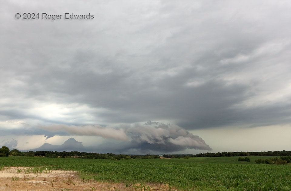
Trailing mostly behind the outflow of a large supercell that I never quite could catch, this storm caught my eye with a low wall cloud visible in the distance from several miles west of here. So I followed this storm for a bit as it moved southeastward toward the Mississippi River and the Missouri/Illinois border. This supercell looked ominous at times, and occasionally showed moderate low-level/cloud-base rotation. However, I never could find any debris nor power flashes under the (by now) bowl-shaped wall cloud, which soon would be undercut by the storm’s own outflow. That very outflow is manifest here as both attached and detached (roll cloud) type arcus shards atop the rear-flank gust front, trailing the wall cloud toward near left. A persistent, funnel-cloud lookalike at distant left, behind the arcus, was both non-rotating and in the wrong place anyway. However, below and just to the lower right of that feature, rose two “scud mountains” in the cool-to-cooler interface between the rear-flank downdraft (RFD) and forward-flank core, upshear of the mesocyclone. Though this entire area soon gusted out, substantial damage occurred to a mechanical storage facility within about 10 minutes, presumably from an intense RFD channel.
1 NNE Steffenville MO (13 Jun 24) Looking NE
39.9921, -91.8768
