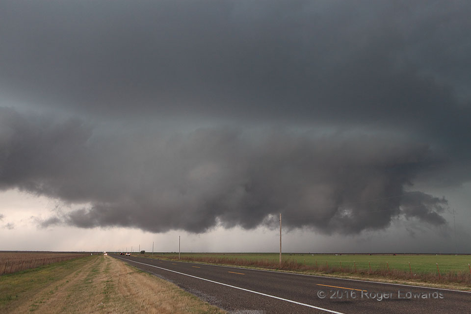
 After a rather small and inefficient first attempt, the succeeding mesocyclonic organization of this storm got a little beefier. The entire convective cluster undermined itself with outflow for over an hour, but not so much as to cut off its own inflow completely. By the time the main updraft reorganized, almost directly over US-70 in southwestern Oklahoma, it formed a long, ragged, yet well-defined wall cloud with inflow tails on both sides. In a broad sense, this feature was rotating, with back-side cloud motions along a north–south (right–left) trail, and the opposite along the front rim. The elongated area of cyclonic shear never could tighten and intensify, however, and outflow again surged through this attempt to implant a mesocyclone in the boundary layer. Another, brief, more compact wall cloud soon followed…
7 SSE Hollister OK (10 Apr 16) Looking WNW
34.2469, -98.8627
After a rather small and inefficient first attempt, the succeeding mesocyclonic organization of this storm got a little beefier. The entire convective cluster undermined itself with outflow for over an hour, but not so much as to cut off its own inflow completely. By the time the main updraft reorganized, almost directly over US-70 in southwestern Oklahoma, it formed a long, ragged, yet well-defined wall cloud with inflow tails on both sides. In a broad sense, this feature was rotating, with back-side cloud motions along a north–south (right–left) trail, and the opposite along the front rim. The elongated area of cyclonic shear never could tighten and intensify, however, and outflow again surged through this attempt to implant a mesocyclone in the boundary layer. Another, brief, more compact wall cloud soon followed…
7 SSE Hollister OK (10 Apr 16) Looking WNW
34.2469, -98.8627Cyclonic Shear Zone
 After a rather small and inefficient first attempt, the succeeding mesocyclonic organization of this storm got a little beefier. The entire convective cluster undermined itself with outflow for over an hour, but not so much as to cut off its own inflow completely. By the time the main updraft reorganized, almost directly over US-70 in southwestern Oklahoma, it formed a long, ragged, yet well-defined wall cloud with inflow tails on both sides. In a broad sense, this feature was rotating, with back-side cloud motions along a north–south (right–left) trail, and the opposite along the front rim. The elongated area of cyclonic shear never could tighten and intensify, however, and outflow again surged through this attempt to implant a mesocyclone in the boundary layer. Another, brief, more compact wall cloud soon followed…
7 SSE Hollister OK (10 Apr 16) Looking WNW
34.2469, -98.8627