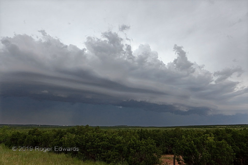
Seasoned Great Plains storm observers often find a late-day supercell absorbed into a nearby line of multicell thunderstorms that evolves into a photogenic but outflow-dominant complex of convection. This was no exception. Some of that convection can be seen here as deep towers directly atop the shelf cloud, where air parcels are forced by lift from the cold density current to slide up over the ramp of outflow, high enough to find a level of free convection (LFC). As that term’s literal words imply, air then shoots up uninhibited by the stable layers that led to the smooth, laminar appearance of the shelf cloud. As the outflow pool proceeded apace, the shelf cloud’s layers would sharpen and spread, with lightning behind becoming more frequent and noticeable.
4 WNW Crowell TX (15 Jun 19) Looking NW
33.9956, -99.8036
