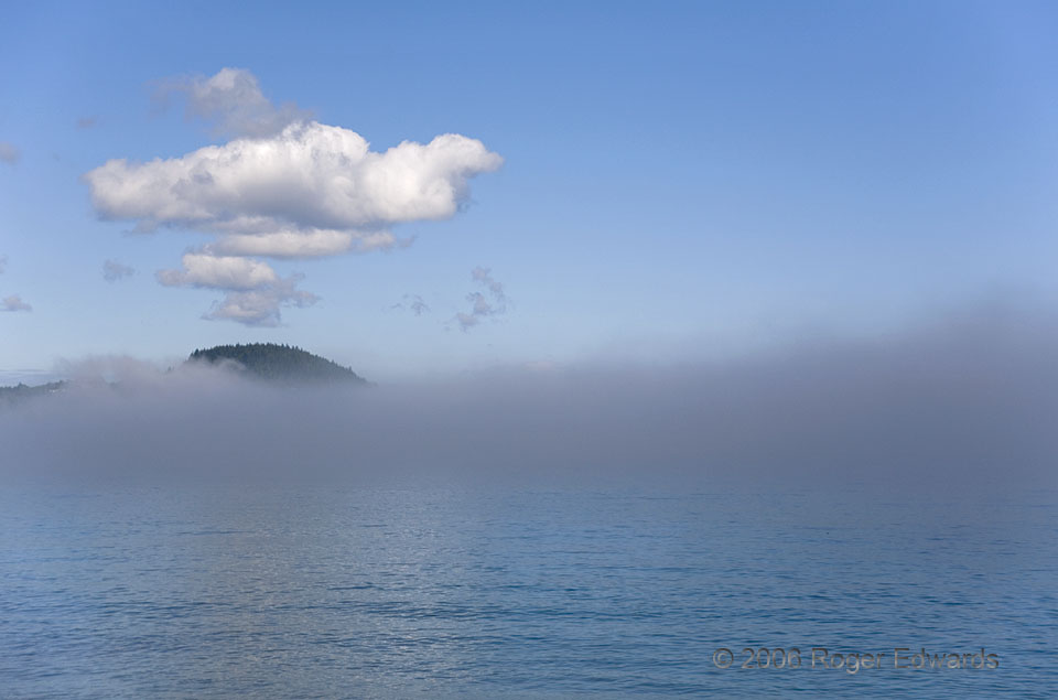
 In this beautiful coastal scene lies something of an atmospheric conundrum. Sea fog itself is fairly common, especially over the shorelines of the Pacific Northwest. Seeing convection of any sort atop the fog, however, was weird, considering that the cool, stable stratification needed for the fog deck seems to contradict the warmth and overturning characteristic beneath cumulus clouds. The secret here lay in orographic lift: the little raised chunk of land formed the tip of a small peninsula that stuck above the stable layer, heated enough after a few hours of morning rays to generate thermals. Given how moist the air mass was, those thermals didn’t need to rise very far to condense, before moving off the hill and weakening.
Clallam Bay WA (15 Jul 6) Looking WNW
48.2554, -124.262
In this beautiful coastal scene lies something of an atmospheric conundrum. Sea fog itself is fairly common, especially over the shorelines of the Pacific Northwest. Seeing convection of any sort atop the fog, however, was weird, considering that the cool, stable stratification needed for the fog deck seems to contradict the warmth and overturning characteristic beneath cumulus clouds. The secret here lay in orographic lift: the little raised chunk of land formed the tip of a small peninsula that stuck above the stable layer, heated enough after a few hours of morning rays to generate thermals. Given how moist the air mass was, those thermals didn’t need to rise very far to condense, before moving off the hill and weakening.
Clallam Bay WA (15 Jul 6) Looking WNW
48.2554, -124.262Convection over Sea Fog
 In this beautiful coastal scene lies something of an atmospheric conundrum. Sea fog itself is fairly common, especially over the shorelines of the Pacific Northwest. Seeing convection of any sort atop the fog, however, was weird, considering that the cool, stable stratification needed for the fog deck seems to contradict the warmth and overturning characteristic beneath cumulus clouds. The secret here lay in orographic lift: the little raised chunk of land formed the tip of a small peninsula that stuck above the stable layer, heated enough after a few hours of morning rays to generate thermals. Given how moist the air mass was, those thermals didn’t need to rise very far to condense, before moving off the hill and weakening.
Clallam Bay WA (15 Jul 6) Looking WNW
48.2554, -124.262