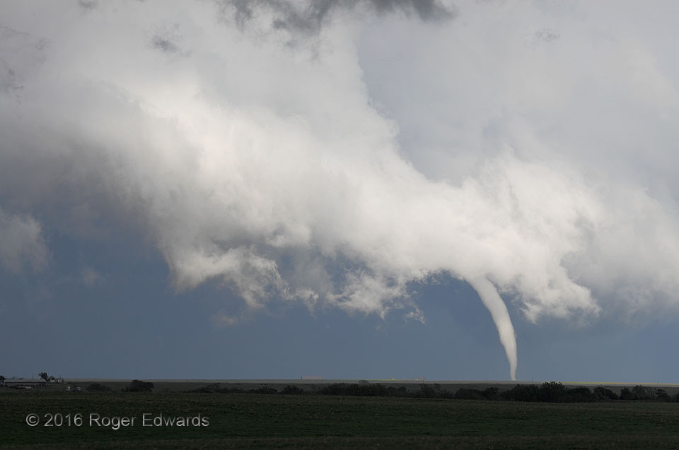
 What a fascinating, surprising event this was! Above is a near-normal view of the same tornado presented earlier in zoomed perspective. Even though the updraft was rotating, it would seem a stretch to call the feature a supercell, since its radar presentation was hardly recognizable, and since the parent cloudform was so disorganized and shredded in appearance. The cloud base is uneven and scuddy, what little updraft there is being very tilted and small. Yet it was a “mini-supercell”, with narrow and well-occluded storm-scale circulation. Imagine this “storm” with no tornado—would you then expect a tornado to form any second? Coincidentally, we viewed this remarkable tube from a spot along the same road and very near where I observed another tornado (in a different direction), five years minus two weeks before this.
2 S Hickory OK (9 May 16) Looking ESE
34.512, -96.8594
RADAR
What a fascinating, surprising event this was! Above is a near-normal view of the same tornado presented earlier in zoomed perspective. Even though the updraft was rotating, it would seem a stretch to call the feature a supercell, since its radar presentation was hardly recognizable, and since the parent cloudform was so disorganized and shredded in appearance. The cloud base is uneven and scuddy, what little updraft there is being very tilted and small. Yet it was a “mini-supercell”, with narrow and well-occluded storm-scale circulation. Imagine this “storm” with no tornado—would you then expect a tornado to form any second? Coincidentally, we viewed this remarkable tube from a spot along the same road and very near where I observed another tornado (in a different direction), five years minus two weeks before this.
2 S Hickory OK (9 May 16) Looking ESE
34.512, -96.8594
RADARConnerville Tornado’s Ragged Updraft
 What a fascinating, surprising event this was! Above is a near-normal view of the same tornado presented earlier in zoomed perspective. Even though the updraft was rotating, it would seem a stretch to call the feature a supercell, since its radar presentation was hardly recognizable, and since the parent cloudform was so disorganized and shredded in appearance. The cloud base is uneven and scuddy, what little updraft there is being very tilted and small. Yet it was a “mini-supercell”, with narrow and well-occluded storm-scale circulation. Imagine this “storm” with no tornado—would you then expect a tornado to form any second? Coincidentally, we viewed this remarkable tube from a spot along the same road and very near where I observed another tornado (in a different direction), five years minus two weeks before this.
2 S Hickory OK (9 May 16) Looking ESE
34.512, -96.8594
RADAR