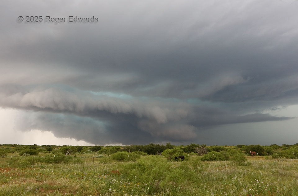
A complex supercell that already had done one prominent mesocyclone jump (to a new occlusion point) was in the process of another here. This was quite evident once we navigated a gnarly but passable dirt road southeastward to avoid the forward-flank core, then zigzagged back southwest into the updrafts’ broader path. A wildflower-festooned foreground field was a nice touch; it soon would take a merciless beating from hail. The more elongated, ragged wall cloud in the background was rotating faster, and garnered a report of a brief tornado that we couldn’t see (though we did find a poorly developed funnel in it a few minutes later when its broader structure was messier still). Meanwhile, the new mesocyclone and associated wall cloud (right of lower center, left of brown cow) already was kicking out a prominent rear-flank downdraft with arcus formation closer to us. About the time of this shot, or just a few minutes before, an ICECHIP field-project crew collected huge hail above 3 inches in diameter, in the core behind the mesocyclones.
6 SW Dumont TX (25 May 25) Looking WNW
33.7729, -100.6087