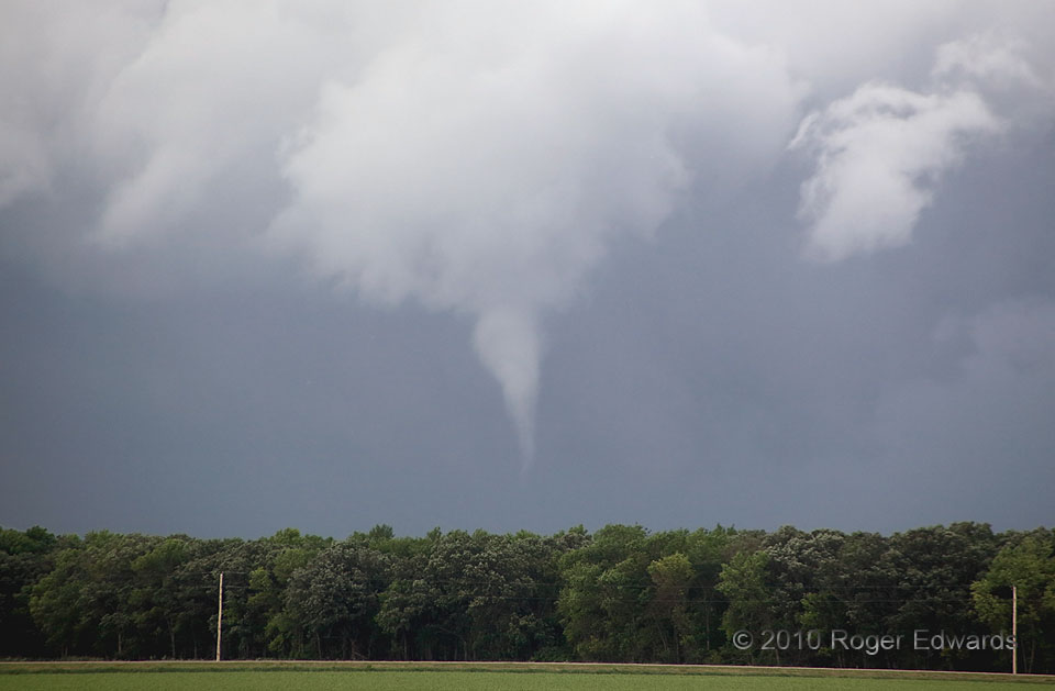
 For years, I had wanted to observe one of the small, often beautiful tornadoes that develop from shallow, fast-moving supercells that develop in arcs of convection, just ahead of a compact middle-upper level low. Colloquially, they’re called “cold-core” tornadoes, after the swath of cold air aloft that accompanies such cyclones, and that contributes to the instability supporting the supercells. This day afforded just such an opportunity. After several non-tornadic supercells, funnels and a brief spinup or two seen farther west in the arc, in North Dakota, this ghostly vortex finally appeared just E of the Minnesota border, not certainly a tornado at first, but most certainly one with time. The small, ragged updraft area aloft didn’t look like much, but it organized quickly as it moved away from us.
3 SSE Fisher MN (17 Jun 10) Looking NNE
47.7566, -96.7815
RADAR
For years, I had wanted to observe one of the small, often beautiful tornadoes that develop from shallow, fast-moving supercells that develop in arcs of convection, just ahead of a compact middle-upper level low. Colloquially, they’re called “cold-core” tornadoes, after the swath of cold air aloft that accompanies such cyclones, and that contributes to the instability supporting the supercells. This day afforded just such an opportunity. After several non-tornadic supercells, funnels and a brief spinup or two seen farther west in the arc, in North Dakota, this ghostly vortex finally appeared just E of the Minnesota border, not certainly a tornado at first, but most certainly one with time. The small, ragged updraft area aloft didn’t look like much, but it organized quickly as it moved away from us.
3 SSE Fisher MN (17 Jun 10) Looking NNE
47.7566, -96.7815
RADARCold-Core Tornado
 For years, I had wanted to observe one of the small, often beautiful tornadoes that develop from shallow, fast-moving supercells that develop in arcs of convection, just ahead of a compact middle-upper level low. Colloquially, they’re called “cold-core” tornadoes, after the swath of cold air aloft that accompanies such cyclones, and that contributes to the instability supporting the supercells. This day afforded just such an opportunity. After several non-tornadic supercells, funnels and a brief spinup or two seen farther west in the arc, in North Dakota, this ghostly vortex finally appeared just E of the Minnesota border, not certainly a tornado at first, but most certainly one with time. The small, ragged updraft area aloft didn’t look like much, but it organized quickly as it moved away from us.
3 SSE Fisher MN (17 Jun 10) Looking NNE
47.7566, -96.7815
RADAR