SkyPix

A digital photographic storybook of clouds, weather and water by Roger Edwards.

  • Home
  • Newest Posts
  • Galleries
    • Aerial
    • All Hail
    • Burnscapes
    • Daytime Lightning
    • Floods
    • Fog and Mist
    • Gallery of Outflow
    • Hurricane Andrew
    • Mini Cloud Atlas
    • Night Lightning
    • Mostly Okie Winters
    • Sunsets and Sunrises
    • The Majestic Supercell
    • Tornadoes
    • Unusual Weather Damage
    • Visual Effects
    • Wall Cloud Wall
    • Water Works
  • About
  • F.A.Q.
  • Contact

Cold-Core Funnel Part 3

2021-01-31 By Roger Edwards

Cold-Core Funnel Part 3

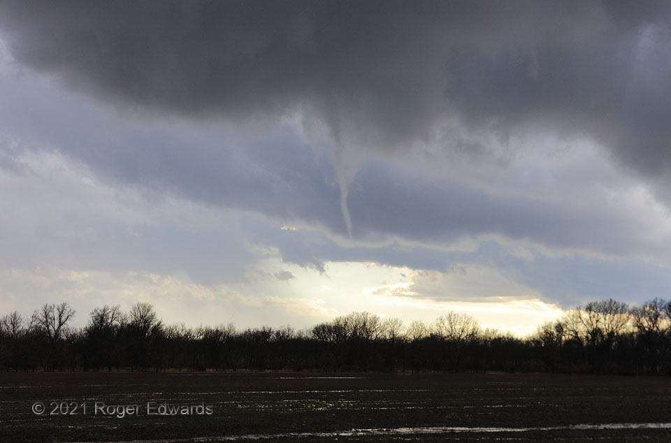
[Part 3 of 3]  How do we get supercells and funnel clouds (and in at least one case elsewhere this day, a brief tornado) when surface temperatures feel so cool (50s F)?  This isn’t a so-called “cold-air” funnel”, but instead, a fully supercellular circulation in the cold-core region of a midtropospheric cyclone.  It’s not common in these parts, but when temperatures 10,000-20,000 feet up are unusually low, atop a seemingly cool but moist near-surface layer, that can yield surface-based instability.  Toss in favorable vertical shear and low-level vorticity, and enough lift near the surface from heating and boundaries, and small, low-topped supercells can spin up.  California’s Central Valley sees at least one or two of these type events almost every winter, with similar surface temperatures.  This was basically a California funnel and weak-tornado setup, but near the western margin of the Ozarks instead!  [Back to Part 1]

2 E Afton OK (30 Jan 21) Looking SW
36.685, -94.9222

Filed Under: Mini Cloud Atlas Tagged With: Afton, clouds, convection, funnel cloud, landscapes, Oklahoma, supercells, thunderstorms, wall clouds, weather

Previous: Cold-Core Funnel Part 2
Next: Happy Union HP

About

Welcome to SkyPix, an online photo book of clouds, weather and water by Roger Edwards. As in a printed coffee-table book, every image has its own page with a unique story. After all, meaningful photography is much more than just picture-taking; it is visually rendering a moment in place and time from a perspective like none other. As a scientist and an artist, I hope my deep passion for the power and splendor of our skies and waters shines through in these pages. If you are a cloud and weather aficionado, outdoor enthusiast, outdoor or nature photographer, art lover, or anyone who craves learning, enjoy...

More

Further images from this photographer may be found at:
Roger Edwards Image of the Week
Roger Edwards Digital Galleries
Storms Observed Chase BLOG

Copyright © 2025 ROGER EDWARDS SKYPIX.PHOTOGRAPHY ALL RIGHTS RESERVED. · Design by INSOJOURN Design and Images · WordPress · Log in