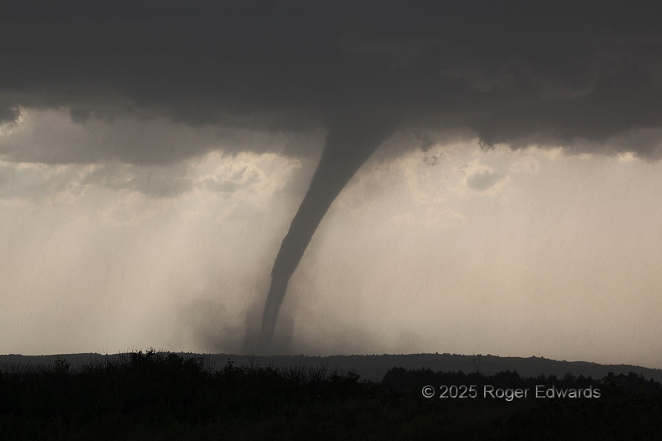
This beautiful tornado was so long-lived (over half an hour) and slow-moving that I was able to view it from a few different vantages and distances, beginning with the farthest but fullest perspective of the whole supercell. Here, several miles closer and using a zoom lens, the structures are so fascinating! Within the inner rim of the forward-flank core containing moderate rain but only small hail, one can see the precipitation streaks all around, as well as centrifuged dust, and inside that, layers of the tornado itself. The dust sheath near the bottom better represents the true width of the tornadic circulation, while the elephant-trunk condensation funnel inside tells us where the pressure was low enough to condense water vapor to cloud. However, since the lower part of the condensation funnel was thin, semi-translucent, with some dry-air intrusion, one can see a lighter-toned vertical cross section through its middle part, or eye. We are fortunate to see these layers so well. Usually denser dust, debris and/or cloud material obscure them. The vortex soon would visibly fatten shortly before dissipating.
1 NW Wellfleet NE (16 Jun 25) Looking WNW
40.7716, -100.741