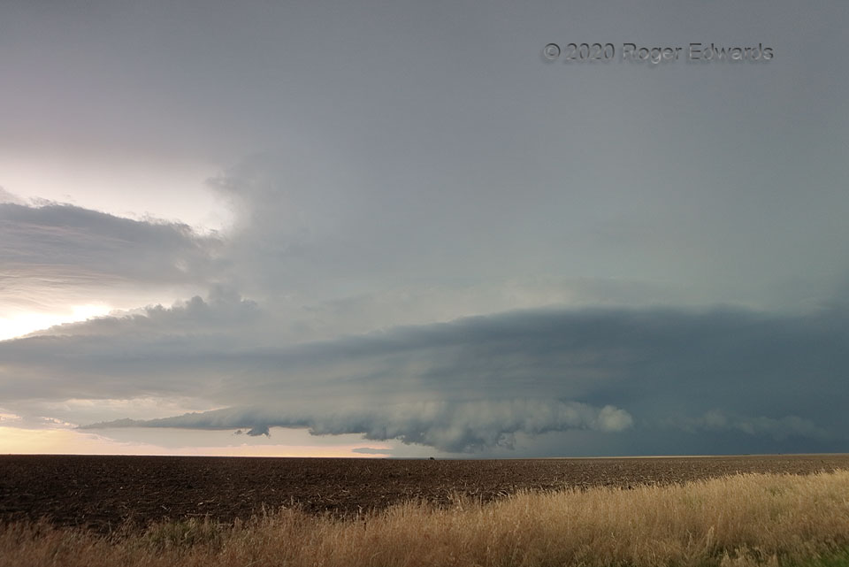
 A cluster of thunderstorms in a marginal-shear environment nonetheless evolved into a couple of nice daytime supercells, this being the first. The second was younger and organizing in the background. This nearer, older storm sported a weakly rotating wall cloud off and on, which in this view is being undercut by both forward- and rear-flank outflow. All of that was happening beneath a series of striations that we often see with supercells in the late afternoon to early evening, as the boundary layer decouples, and slightly cooler and more-stable air gets forced upward in layers by the low-pressure area internal to the rotating thunderstorm. The nearer storm would become elevated atop its own outflow and gradually wind down, while the second evolved wonderfully through the sunset hour and persisted after dark as a spectacularly lightning-lit, “stack of plates” formation.
10 NW Offerle KS (20 Jun 20) Looking NW
38.015, -99.6431
A cluster of thunderstorms in a marginal-shear environment nonetheless evolved into a couple of nice daytime supercells, this being the first. The second was younger and organizing in the background. This nearer, older storm sported a weakly rotating wall cloud off and on, which in this view is being undercut by both forward- and rear-flank outflow. All of that was happening beneath a series of striations that we often see with supercells in the late afternoon to early evening, as the boundary layer decouples, and slightly cooler and more-stable air gets forced upward in layers by the low-pressure area internal to the rotating thunderstorm. The nearer storm would become elevated atop its own outflow and gradually wind down, while the second evolved wonderfully through the sunset hour and persisted after dark as a spectacularly lightning-lit, “stack of plates” formation.
10 NW Offerle KS (20 Jun 20) Looking NW
38.015, -99.6431Circulatory Sky
 A cluster of thunderstorms in a marginal-shear environment nonetheless evolved into a couple of nice daytime supercells, this being the first. The second was younger and organizing in the background. This nearer, older storm sported a weakly rotating wall cloud off and on, which in this view is being undercut by both forward- and rear-flank outflow. All of that was happening beneath a series of striations that we often see with supercells in the late afternoon to early evening, as the boundary layer decouples, and slightly cooler and more-stable air gets forced upward in layers by the low-pressure area internal to the rotating thunderstorm. The nearer storm would become elevated atop its own outflow and gradually wind down, while the second evolved wonderfully through the sunset hour and persisted after dark as a spectacularly lightning-lit, “stack of plates” formation.
10 NW Offerle KS (20 Jun 20) Looking NW
38.015, -99.6431