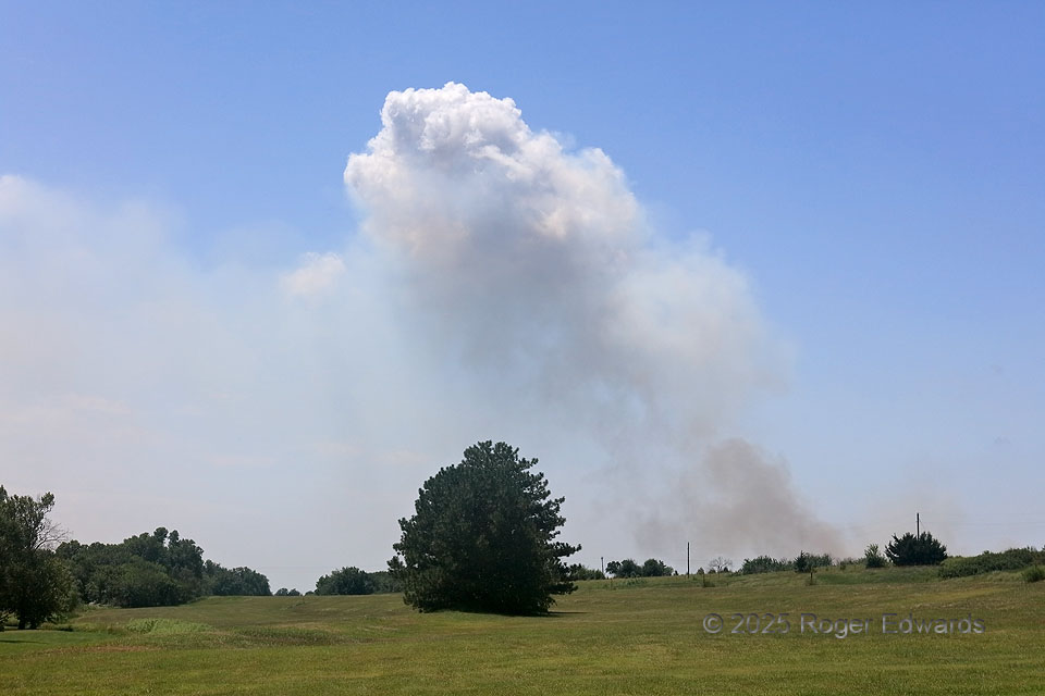
Agricultural burning, that got a little bit out of control, raised a plume of smoke in the area that I could see for about 20 minutes before stopping at about the nearest reasonably accessible view. Episodic pyrocumuli (flammagenitus) bubble over the top of the plume whenever pulses were hot and/or moist enough to raise the pyroconvective column to a condensation level, on an otherwise fairly stable, post-frontal midday. In the left to center distance, deeper convection can be seen closer to the front (to the S and SW). Another 20 minutes here and the situation was starting to be contained as I drove away, with only faint, thin smoke apparent.
2 NNW New Gottland KS (11 Jul 25) Looking SW
38.4834, -97.6212