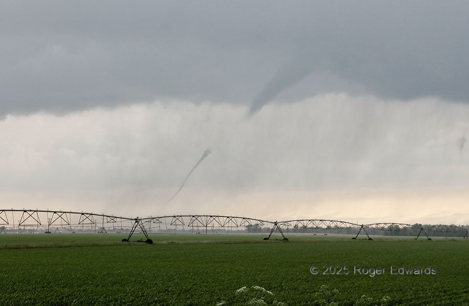
The second and last discrete supercell we intercepted in the Upper Delta event produced two brief, small tornadoes for us in a hazy and very moist environment, before racing across the Mississippi River and into Kentucky, on a track just north of the earlier supercell. This was the first of the second supercell’s tornadoes. Note the breaks in condensation. The actual tube of tornadic wind was continuous between the visible segments, and of course below the lower segment to ground, where a condensation/spray puff is seen in the field, beyond and to the right of the first set of center-pivot irrigator wheels. The apparent gaps simply reveal where the pressure drop wasn’t strong enough in the tube, and/or the humidity not quite high enough, to cool and condense water vapor.
1 W Haywood City MO (16 May 25) Looking NW
37.008, -89.6194