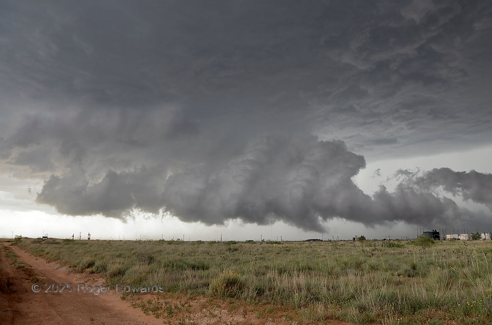
This dryline-initiated supercell had chugged along eastward from the New Mexico border area, rather high-based and producing occasional severe hail, but otherwise nothing out of ordinary. An outflow boundary from a severe, heavy-precip supercell near Lubbock (that itself went up on an old outflow) surged west-southwestward and decelerated in this direction, but still was strong and moving. I anticipated the interaction of that boundary with the younger supercell, and positioned in the immediate inflow region, and was rewarded with this highly dynamic wall cloud, and a few brief, small tornadoes that followed. The wall cloud didn’t exist ten minutes earlier, but when the storm’s updraft started ingesting vorticity-rich and somewhat cooler (but still unstable) outflow air, it was as if a giant match lit under the storm. The condensation level lowered, and the developing wall cloud became strongly convective, as can be seen from the rising cumuliform turrets in its midst. Intense convergence was obvious from all sides, with rapid rising motion in the middle. Horizontal rotation appeared at the base of the tail cloud at right, as well as under the main part of the wall cloud. I’ve seen a tornado from a tail cloud like this before, so that needed close scrutiny too. The whole scene was evolving fast! It was showtime.
2 S Sundown TX (6 Jun 25) Looking NW
33.4256, -102.4902