 Rising up to about 4,000 ft above the base elevation at Rapid City, the Black Hills actually are a low mountain range that initiates thunderstorms regularly in the spring and summer before the surrounding High Plains. This happens in two main ways:
1. Upslope lift of a moist boundary layer, especially in an east or northeast wind (which also lengthens shear vectors to favor supercells under any westerly component of winds above), and
2. Heating of higher terrain that is physically closer and more erosive to the capping inversion aloft.
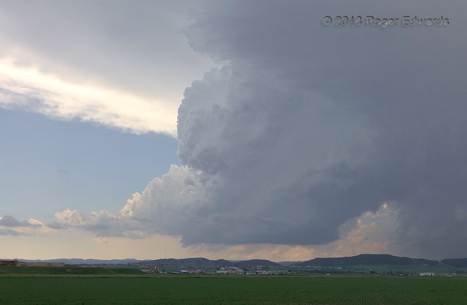
This supercell formed exactly that way, slowly bubbling and building atop the northern Black Hills for about two hours after I saw the first distant towers from east of Buffalo, WY. That gradual development gave me time to wheel around the northern Hills and position for observation to the storm’s east, where terrain blockage of visibility would be minimal. With only modest winds aloft, the storm hugged the east side of the hills for most of another two hours after maturing into a supercell, moving slowly south-southeast. About ten minutes before this shot, it dropped hail up to the size of baseballs west of Rapid City, in the area of precipitation at right.
4 NE Rapid City SD (8 Jun 18) Looking WSW
44.1146, -103.1514
Rising up to about 4,000 ft above the base elevation at Rapid City, the Black Hills actually are a low mountain range that initiates thunderstorms regularly in the spring and summer before the surrounding High Plains. This happens in two main ways:
1. Upslope lift of a moist boundary layer, especially in an east or northeast wind (which also lengthens shear vectors to favor supercells under any westerly component of winds above), and
2. Heating of higher terrain that is physically closer and more erosive to the capping inversion aloft.
This supercell formed exactly that way, slowly bubbling and building atop the northern Black Hills for about two hours after I saw the first distant towers from east of Buffalo, WY. That gradual development gave me time to wheel around the northern Hills and position for observation to the storm’s east, where terrain blockage of visibility would be minimal. With only modest winds aloft, the storm hugged the east side of the hills for most of another two hours after maturing into a supercell, moving slowly south-southeast. About ten minutes before this shot, it dropped hail up to the size of baseballs west of Rapid City, in the area of precipitation at right.
4 NE Rapid City SD (8 Jun 18) Looking WSW
44.1146, -103.1514Black Hills Supercell
 Rising up to about 4,000 ft above the base elevation at Rapid City, the Black Hills actually are a low mountain range that initiates thunderstorms regularly in the spring and summer before the surrounding High Plains. This happens in two main ways:
1. Upslope lift of a moist boundary layer, especially in an east or northeast wind (which also lengthens shear vectors to favor supercells under any westerly component of winds above), and
2. Heating of higher terrain that is physically closer and more erosive to the capping inversion aloft.
This supercell formed exactly that way, slowly bubbling and building atop the northern Black Hills for about two hours after I saw the first distant towers from east of Buffalo, WY. That gradual development gave me time to wheel around the northern Hills and position for observation to the storm’s east, where terrain blockage of visibility would be minimal. With only modest winds aloft, the storm hugged the east side of the hills for most of another two hours after maturing into a supercell, moving slowly south-southeast. About ten minutes before this shot, it dropped hail up to the size of baseballs west of Rapid City, in the area of precipitation at right.
4 NE Rapid City SD (8 Jun 18) Looking WSW
44.1146, -103.1514