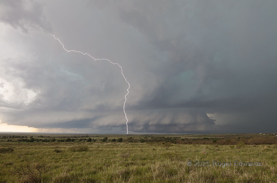
This broad, deep supercell formed over my head at Buc-Ee’s in east Amarillo, then went hiding in terrain for awhile. It was content to make me go way out ahead and wait for it to leave the relative road void of the Palo Duro Canyon, while it charged southeastward right down said canyon unrestrained by road concerns, and while electrically bombarding the area around this spot. One among dozens of cloud-to-ground strikes from the downshear anvil sizzled a piece of land on the next ridge in the storm’s direction, as a friend and I stood outside out respective vehicles with cameras on tripods. A similar but only reflectively seen flash less than a mile behind us, a few seconds later, sent us hastily back into the vehicles and down the road several miles, to escape the barrage. Meanwhile, to no surprise of mine, this storm pounded “ICECHIP” research vehicles on the one road to our west with hail 2-3 inches in diameter, with other reports exceeding 4 inches. Unusually, this storm would give me nice daytime lightning shots from three places: here, the next stop to the south, and over an hour and a half to the southeast, while looking furious at another stop in between. This was eventful and photographically rich for a fast-moving, nontornadic storm!
3 NNW Brice TX (8 Jun 25) Looking W
34.7457, -100.9021