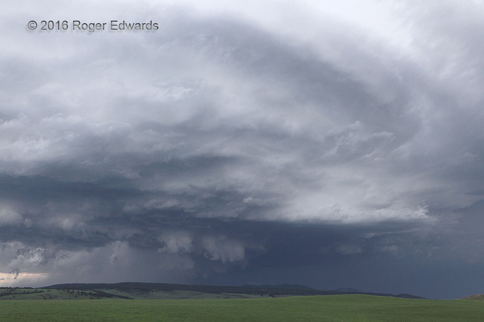
 Our third central Montana supercell of the afternoon was the largest and longest-lasting for us, paralleling the highway from Denton to Roy, mainly to the route’s north. Here, it wrapped up a tight low-level mesocyclone, only to mostly undercut itself with outflow in the next ten minutes, then wrap up once again north of Roy. Both times, we were not certain whether it was tornadic. Yes, that was a funnel cloud beneath the wall cloud, near lower center. It lasted around 3 minutes, amidst the surrounding, scuddy rotation. Unfortunately, we neither had a cellular phone signal with which to report it (a common occurrence for us on the High Plains), nor did we ever get a sure sign that it was tornadic (obvious debris cloud or power flashes), thanks to the intervening hills and remoteness of the area affected. Regardless, the storm put on a magnificent structural and evolutionary show as it cruised eastward along the northern flanks of the Judith Range.
Brooks MT (10 Jun 16) Looking NW
47.2085, -109.4247
Our third central Montana supercell of the afternoon was the largest and longest-lasting for us, paralleling the highway from Denton to Roy, mainly to the route’s north. Here, it wrapped up a tight low-level mesocyclone, only to mostly undercut itself with outflow in the next ten minutes, then wrap up once again north of Roy. Both times, we were not certain whether it was tornadic. Yes, that was a funnel cloud beneath the wall cloud, near lower center. It lasted around 3 minutes, amidst the surrounding, scuddy rotation. Unfortunately, we neither had a cellular phone signal with which to report it (a common occurrence for us on the High Plains), nor did we ever get a sure sign that it was tornadic (obvious debris cloud or power flashes), thanks to the intervening hills and remoteness of the area affected. Regardless, the storm put on a magnificent structural and evolutionary show as it cruised eastward along the northern flanks of the Judith Range.
Brooks MT (10 Jun 16) Looking NW
47.2085, -109.4247Big Sky, Big Supercell
 Our third central Montana supercell of the afternoon was the largest and longest-lasting for us, paralleling the highway from Denton to Roy, mainly to the route’s north. Here, it wrapped up a tight low-level mesocyclone, only to mostly undercut itself with outflow in the next ten minutes, then wrap up once again north of Roy. Both times, we were not certain whether it was tornadic. Yes, that was a funnel cloud beneath the wall cloud, near lower center. It lasted around 3 minutes, amidst the surrounding, scuddy rotation. Unfortunately, we neither had a cellular phone signal with which to report it (a common occurrence for us on the High Plains), nor did we ever get a sure sign that it was tornadic (obvious debris cloud or power flashes), thanks to the intervening hills and remoteness of the area affected. Regardless, the storm put on a magnificent structural and evolutionary show as it cruised eastward along the northern flanks of the Judith Range.
Brooks MT (10 Jun 16) Looking NW
47.2085, -109.4247