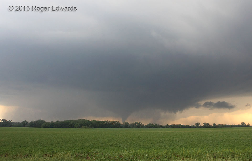
The legendary Bennington vortex of 2013 started with a classical condensation cone under a wall cloud, with active, fast-moving and scuddy inflow tail pointing toward the forward flank, as I’ve seen with many significant tornadoes. All of that was happening under a heavy-looking, wet, low, somewhat hazy ambient supercell base, unsurprising for a high-CAPE, high-dewpoint supercell latched into a stationary or warm front. Of course, this tornado would fatten considerably, move very little, and last a long time!
1 NW Bennington KS (28 May 13) Looking WSW
39.0409, -97.6126