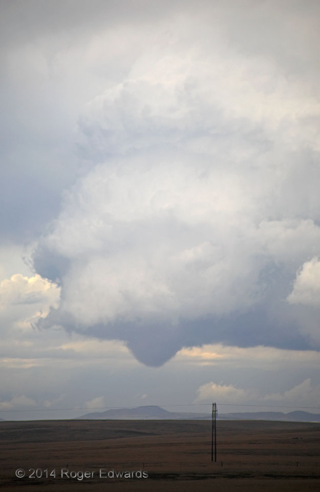
 After its impressive debut (especially for a high-based storm that hadn’t threatened to produce for a long time beforehand), this surprise tornado continued to churn along at slow forward speeds across the high tablelands of northeastern New Mexico, for more than 10 minutes. Very faint, occasional wisps of rotating dust occasionally rose off the ground during this final stage, when a well-developed, bowl-shaped condensation funnel again appeared. [At other times after the early stages, the debris cloud was better defined but without a funnel.] I believe the circulation was continuous in time throughout—in other words, one single tornado that I’m counting as such—despite the lack of damage indicators, mobile radar, or other ways to confirm temporal continuity. Though its contrast was muted some by a hazy atmosphere, the corkscrewing convection through a great depth above a tornado was a treat to behold as well. Within another 15 minutes, the entire supercell would vanish into a melange of messy convection and precip that had developed to its east and southeast, and we would engage intercept operations with another supercell moving hard right near Solano and Mosquero.
1 S Abbott NM (6 Jun 14) Looking NNE
36.2909, -104.259
RADAR
After its impressive debut (especially for a high-based storm that hadn’t threatened to produce for a long time beforehand), this surprise tornado continued to churn along at slow forward speeds across the high tablelands of northeastern New Mexico, for more than 10 minutes. Very faint, occasional wisps of rotating dust occasionally rose off the ground during this final stage, when a well-developed, bowl-shaped condensation funnel again appeared. [At other times after the early stages, the debris cloud was better defined but without a funnel.] I believe the circulation was continuous in time throughout—in other words, one single tornado that I’m counting as such—despite the lack of damage indicators, mobile radar, or other ways to confirm temporal continuity. Though its contrast was muted some by a hazy atmosphere, the corkscrewing convection through a great depth above a tornado was a treat to behold as well. Within another 15 minutes, the entire supercell would vanish into a melange of messy convection and precip that had developed to its east and southeast, and we would engage intercept operations with another supercell moving hard right near Solano and Mosquero.
1 S Abbott NM (6 Jun 14) Looking NNE
36.2909, -104.259
RADARBarely Tornadic Bowl
 After its impressive debut (especially for a high-based storm that hadn’t threatened to produce for a long time beforehand), this surprise tornado continued to churn along at slow forward speeds across the high tablelands of northeastern New Mexico, for more than 10 minutes. Very faint, occasional wisps of rotating dust occasionally rose off the ground during this final stage, when a well-developed, bowl-shaped condensation funnel again appeared. [At other times after the early stages, the debris cloud was better defined but without a funnel.] I believe the circulation was continuous in time throughout—in other words, one single tornado that I’m counting as such—despite the lack of damage indicators, mobile radar, or other ways to confirm temporal continuity. Though its contrast was muted some by a hazy atmosphere, the corkscrewing convection through a great depth above a tornado was a treat to behold as well. Within another 15 minutes, the entire supercell would vanish into a melange of messy convection and precip that had developed to its east and southeast, and we would engage intercept operations with another supercell moving hard right near Solano and Mosquero.
1 S Abbott NM (6 Jun 14) Looking NNE
36.2909, -104.259
RADAR