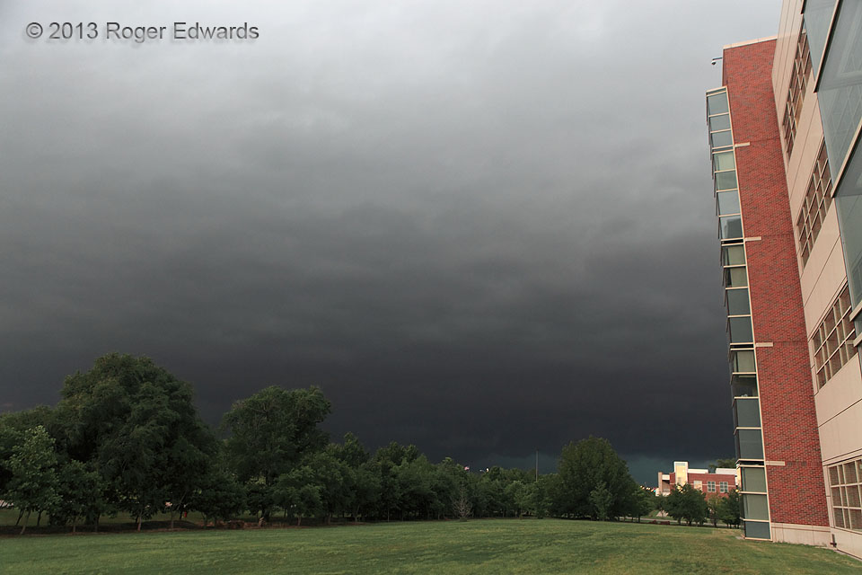
 After merging with some other convection, the broader, messier but only weakly tornadic version of the El Reno supercell presents an unusually dark, ominous face while looming beyond the National Weather Center. There I took a very brief break from outlook and forecast-support duties to spot the incoming storm, take this photo, and assess its potential to produce a tornado close enough for backup procedures (the potentially tornadic part slid by a few miles to the north). A deck of nimbostratus clouds formed in the broad field of low-level lift preceding the storm, and was made progressively darker by the deepening shadow of the mostly unseen, giant, very deep cumulonimbus above. Even lacking obvious, classical structures, this storm was majestic in a menacing way. I knew at the time that an earlier version of this storm produced a huge, violent tornado near El Reno, but would not learn until after midnight that it had killed two of my friends and colleagues and another who was with them.
Norman OK (31 May 13) Looking NNW
35.1815, -97.4407
After merging with some other convection, the broader, messier but only weakly tornadic version of the El Reno supercell presents an unusually dark, ominous face while looming beyond the National Weather Center. There I took a very brief break from outlook and forecast-support duties to spot the incoming storm, take this photo, and assess its potential to produce a tornado close enough for backup procedures (the potentially tornadic part slid by a few miles to the north). A deck of nimbostratus clouds formed in the broad field of low-level lift preceding the storm, and was made progressively darker by the deepening shadow of the mostly unseen, giant, very deep cumulonimbus above. Even lacking obvious, classical structures, this storm was majestic in a menacing way. I knew at the time that an earlier version of this storm produced a huge, violent tornado near El Reno, but would not learn until after midnight that it had killed two of my friends and colleagues and another who was with them.
Norman OK (31 May 13) Looking NNW
35.1815, -97.4407Bad Storm Coming
 After merging with some other convection, the broader, messier but only weakly tornadic version of the El Reno supercell presents an unusually dark, ominous face while looming beyond the National Weather Center. There I took a very brief break from outlook and forecast-support duties to spot the incoming storm, take this photo, and assess its potential to produce a tornado close enough for backup procedures (the potentially tornadic part slid by a few miles to the north). A deck of nimbostratus clouds formed in the broad field of low-level lift preceding the storm, and was made progressively darker by the deepening shadow of the mostly unseen, giant, very deep cumulonimbus above. Even lacking obvious, classical structures, this storm was majestic in a menacing way. I knew at the time that an earlier version of this storm produced a huge, violent tornado near El Reno, but would not learn until after midnight that it had killed two of my friends and colleagues and another who was with them.
Norman OK (31 May 13) Looking NNW
35.1815, -97.4407