SkyPix

A digital photographic storybook of clouds, weather and water by Roger Edwards.

  • Home
  • Newest Posts
  • Galleries
    • Aerial
    • All Hail
    • Burnscapes
    • Daytime Lightning
    • Floods
    • Fog and Mist
    • Gallery of Outflow
    • Hurricane Andrew
    • Mini Cloud Atlas
    • Night Lightning
    • Mostly Okie Winters
    • Sunsets and Sunrises
    • The Majestic Supercell
    • Tornadoes
    • Unusual Weather Damage
    • Visual Effects
    • Wall Cloud Wall
    • Water Works
  • About
  • F.A.Q.
  • Contact

Almost

2023-10-27 By Roger Edwards

Almost

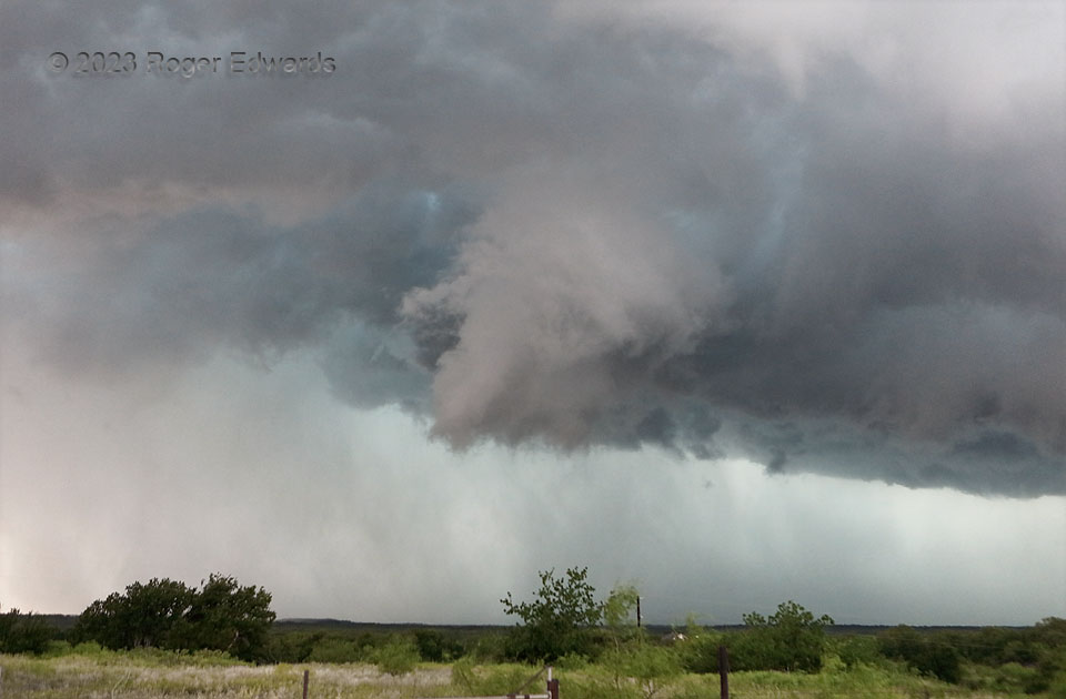
On the first supercell of the day that I intercepted, a broad, scuddy, poorly defined wall cloud narrowed and tightened up noticeably just a mile or two to my west, about the time a radar-based tornado warning was issued.  It assumed a tilted, somewhat conical shape with peak low-level rotation strength right at this time, and I was watching the ground beneath closely for evidence of debris that never appeared, ready to report tornadogenesis if necessary.  Quite often (most often), when I’m in optimal yet safe position for viewing, and contrast is best (on what was an otherwise hazy day), the concentrated cloud-base rotation area fall apart.  [For a highly uncommon exception somewhat resembling this, look here.]  This fell apart, but not before tantalizing teasing.  The storm would move northeast into a road hole, get warned another time or two, produce no tornadoes, and merge into a mess of convection before another supercell fired west of Brownwood, off the edge of the combined outflow.

2 ESE Grosvenor TX (6 May 23) Looking WNW
31.8772, -99.1204

Filed Under: Wall Cloud Wall Tagged With: Brownwood, clouds, convection, Great Plains, Grosvenor, Hill Country, landscapes, storms, supercells, Texas, thunderstorms, wall clouds, weather

Previous: Transitions
Next: Supercell Outflow Dominance

About

Welcome to SkyPix, an online photo book of clouds, weather and water by Roger Edwards. As in a printed coffee-table book, every image has its own page with a unique story. After all, meaningful photography is much more than just picture-taking; it is visually rendering a moment in place and time from a perspective like none other. As a scientist and an artist, I hope my deep passion for the power and splendor of our skies and waters shines through in these pages. If you are a cloud and weather aficionado, outdoor enthusiast, outdoor or nature photographer, art lover, or anyone who craves learning, enjoy...

More

Further images from this photographer may be found at:
Roger Edwards Image of the Week
Roger Edwards Digital Galleries
Storms Observed Chase BLOG

Copyright © 2025 ROGER EDWARDS SKYPIX.PHOTOGRAPHY ALL RIGHTS RESERVED. · Design by INSOJOURN Design and Images · WordPress · Log in