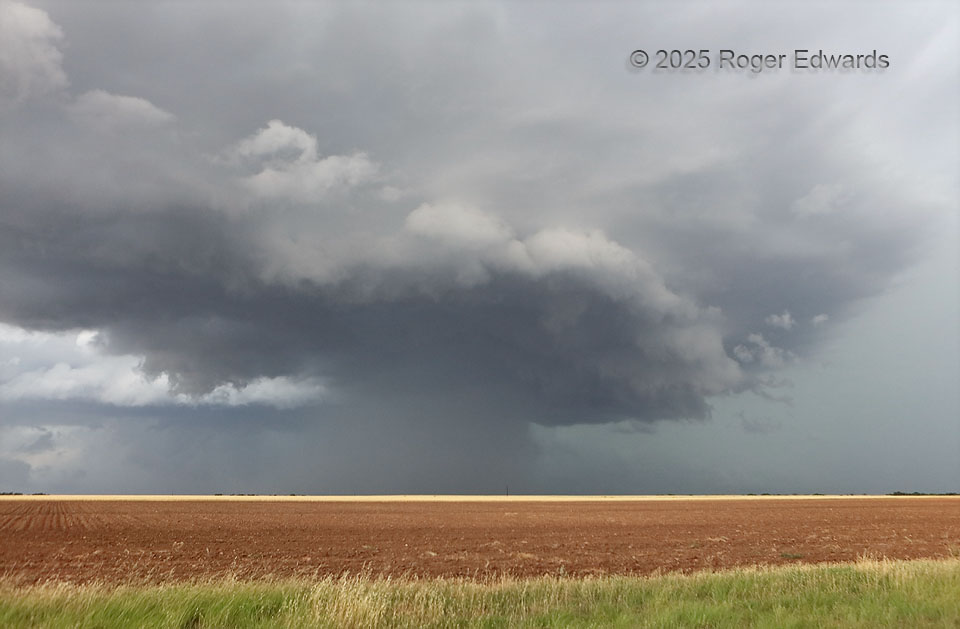
Homing in on a big, nasty (but nicely structured) HP supercell from the northeast, we didn’t expect that it would divide into a multiple-mesocyclone complex as we got close enough for a look beneath. Yet it did. This was the northernmost of them, seemingly doomed for two reasons: 1) a dense cascade of precipitation already was plunging through the cloud base in the southern (nearest) part of the mesocyclone region, with an extensive downdraft and associated shelf wrapping and surging to its south through east, and 2) most of the storm loomed to our southwest and west (left), unseen in this photo, and it was moving to the east-southeast. This meant we had to get south, pronto, but not before I noted in real time this scene’s resemblance to the higher-based “412 Storm” in northern Oklahoma, 14 years earlier.
5 W Paint Creek TX (25 May 25) Looking NW
33.0602, -99.761